Military Takes Over San Diego Borderlands: What It Means for Hikers, Off-Roaders, and the PCT
The stretch of wild, rugged land hugging San Diego County’s southern edge has long been a quiet haven for hikers, off-road enthusiasts, rock climbers, and thru-hikers beginning one of the world’s great long-distance trails. That era is now giving way to something new: formal military control.
In December 2025, Secretary of the Interior Doug Burgum announced the transfer of roughly 760 acres of public land in San Diego and Imperial Counties to the U.S. Navy for a three-year period. The land — a narrow corridor along the U.S. side of the border, originally reserved by President Theodore Roosevelt in 1907 for border protection purposes — is now a federally designated National Defense Area (NDA), a militarized zone under the full jurisdiction of the U.S. Armed Forces. The NDA stretches from the western boundary of the Otay Mountain Wilderness east to approximately one mile west of the California-Arizona state line.
California is the fifth state to receive this designation, joining New Mexico, Texas (twice), and Arizona in a sweeping militarization of the U.S.-Mexico border that began under an April 2025 National Security Presidential Memorandum directing what the Trump administration called the “Military Mission for Sealing the Southern Border.”
For San Diego’s outdoor recreation community, the practical and symbolic consequences are already being felt.
What Is a National Defense Area?
A National Defense Area is, in essence, a stretch of federally owned land placed under the direct authority of one or more branches of the U.S. military — treated the same as any permanent installation like Camp Pendleton or Fort Bragg. The designation empowers troops to apprehend anyone found on the land for trespassing, the same as on any military base. For U.S. citizens, that means potential trespassing charges. For noncitizens without legal status, it opens the door to additional criminal charges including unauthorized entry onto military property and willful violation of a security regulation — charges that carry prison time.
The California NDA is controlled by the Navy, on land described by the administration as among the highest-traffic corridors for unlawful crossings on the southern border. Secretary Burgum said the goal was to “close long-standing security gaps” and protect public lands from unlawful use.
Not everyone agrees. According to the Los Angeles Times, San Diego County Board of Supervisors Chair Terra Lawson-Remer called the action “unnecessary” and said it “threatens basic principles like the rule of law and civil liberties.” U.S. Rep. Juan Vargas (D-San Diego), whose district includes part of the border, told the Times he had “serious concerns about repeated attempts to blur the lines between the military and immigration enforcement.”
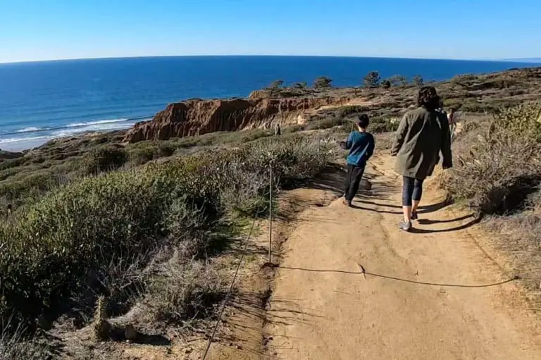
The PCT Southern Terminus: A Tradition Ended
For thru-hikers, the southern terminus of the Pacific Crest Trail at Campo is sacred ground. Every year, thousands of hikers make their way to the monument near the border wall to begin one of the defining adventures of the outdoor world. For many, that beginning included a specific ritual: walking the short distance south to touch the border wall itself, a physical connection to one edge of the continent before heading to the other.
That tradition is now gone.
When the NDA was first announced in December 2025, the PCTA said it appeared the zone ended just outside the terminus and might not affect trail access. That assessment changed. In an update posted February 11, 2026, the PCTA confirmed that the 60-foot-wide NDA corridor — which includes both the border wall and the road south of the monument — is now off-limits. A barbed wire fence just south of the monument marks the boundary of the militarized zone.
The monument itself, and the trail heading north, remains fully accessible.
“While the monument remains the official start of the Pacific Crest Trail, we know that for many people, walking to the wall has been a long-standing personal ritual,” wrote PCTA Southern California Regional Representative Anitra Kass. “It is disappointing to lose that tradition. At the same time, it is important that all visitors respect posted boundaries and follow current regulations.”
Her practical guidance: “After visiting the monument, I recommend heading directly north on the trail.”
The PCT is not alone. In fall 2025, contractors working for the Department of Homeland Security blocked off the southern terminus of the Arizona Trail with concertina wire. Access to the Continental Divide Trail’s southern terminus in New Mexico is restricted under that state’s NDA rules, effectively banning international hikers. The southern termini of America’s three great long trails are all, to varying degrees, now caught up in federal border enforcement.
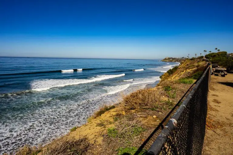
Otay Mountain Wilderness: Where the NDA Begins
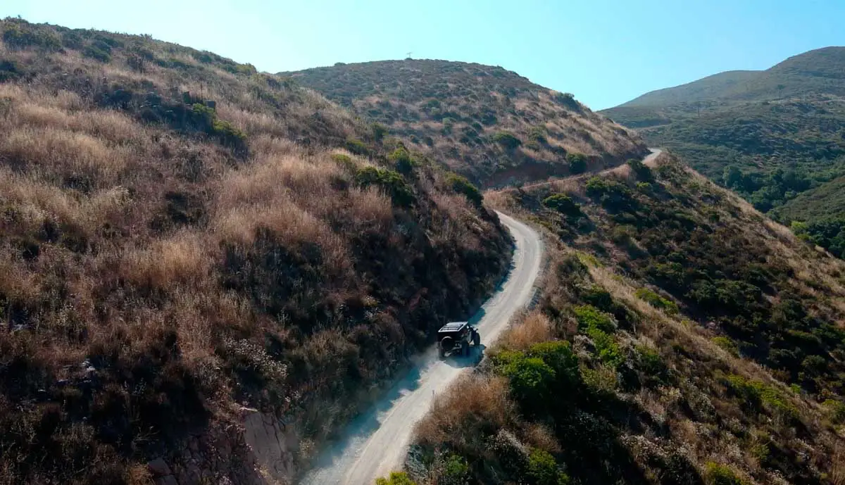
The western anchor of San Diego’s new NDA is the Otay Mountain Wilderness, a nearly 17,000-acre expanse of rugged terrain in the San Ysidro Mountains of southernmost San Diego County, managed by the Bureau of Land Management. It is also, via the Otay Mountain Truck Trail, one of San Diego County’s most popular off-roading and overlanding routes — and a favorite for hikers and mountain bikers as well.
The truck trail network has three primary entrance points: a northern entrance off Otay Lakes Road next to Pio Pico RV Resort and Campground, a southwestern entrance off Alta Road near Otay Mesa, and an eastern entrance from Marron Valley Road. Roughly halfway through the network is Doghouse Junction, where the trail’s three sections converge. The wilderness also hosts a unique ecosystem, including the only known stand of Tecate cypress and habitat for the endangered quino checkerspot butterfly.
The key point for recreationists: the NDA does not encompass Otay Mountain Wilderness. The NDA’s western terminus is the wilderness area’s boundary — not the interior of it. The truck trail and the wilderness above remain open and accessible. Confirmed reports from off-roaders indicate the truck trail is still open through its current access points.
Worth noting: the truck trail has long been used by U.S. Border Patrol to monitor the border immediately to the south. The NDA designation adds a military dimension to that already active enforcement presence. Recreationists should stay on established trails and stay clear of the border-adjacent NDA strip to the south.
Valley of the Moon: Still Open
Valley of the Moon, a popular destination for off-roaders and rock climbers near the eastern end of the NDA corridor, remains open for recreation. Visitors who have been to the area recently report that access is intact for both off-roading and climbing.
As with Otay Mountain, the NDA runs along the border itself — not through the recreation area. But anyone heading out there should be aware that the border edge is now a militarized zone and should stay clear of it.
What Comes Next?
The land transfer to the Navy is set for three years, running through at least late 2028. How the NDA evolves during that period — whether access restrictions expand, whether the military presence grows, whether the corridor affects wildlife and water in adjacent wilderness areas — is not yet known.
What is clear is the direction of travel. The backcountry borderlands of Southern California — long a place where the outdoors felt genuinely remote — are being drawn more tightly into the apparatus of federal security enforcement. For now, most of the recreation areas Southern California off-roaders and hikers love remain open. But the landscape, literally and figuratively, is changing.
For PCT hikers: The terminus monument is accessible. The trail is open. Do not cross the barbed wire fence south of the monument. Follow PCTA guidance and head north after visiting the monument.
For Otay Mountain Wilderness visitors: The truck trail and wilderness area remain open via current access points. Stay away from the border-adjacent NDA strip along the southern edge of the wilderness.
For Valley of the Moon visitors: The area remains open for off-roading and climbing. Give the border edge itself a wide berth.
For the latest on PCT access, visit pcta.org.