Ho Chi Minh Trail Guide – San Diego
Ho Chi Minh Trail in San Diego, California, is a difficult and potentially dangerous hike down the high ocean bluffs of La Jolla through a steep canyon that brings you to Blacks Beach.
This trail (also known as Saigon Trail) is for only the most adventurous hikers as it requires passing through a narrow slot and delicate footwork on a slippery shelf trail where a fall can cause injury–and does at times. I have taken people down the trail who have refused to go back up. If you are looking for a much mellower slot canyon hike, check out Annie’s Canyon Trail, a few miles north in Solana Beach.
Warnings aside, the trail travels through a dramatic canyon, Box Canyon, on La Jolla’s Torrey Pines Mesa and has long been used by surfers to get to the waves at Blacks Beach. For the sure of foot, it’s a quick way to get to main breaks on Blacks and a fun, adventurous hike. There are other ways to get to Blacks Beach, if that’s your main objective, including a paved road and the trail down from Torrey Pines Gliderport.
Trail Details
- Trail type: Out-and-back
- Difficulty: Very Difficult
- Length: .3 miles
- Elevation gain and loss: 280 feet, -280 feet
- Trailhead Coordinates: 32.885198, -117.249195
- Location: La Jolla, California
- Season: Year-round
Getting to Ho Chi Mihn Trail
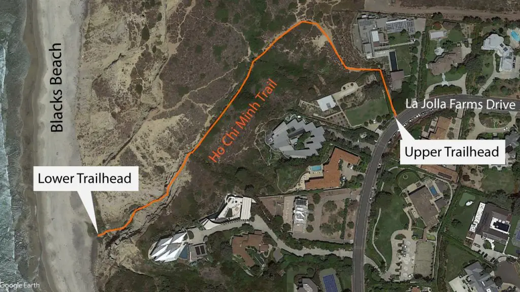
The trailhead for Ho Chi Mihn Trail is located off a street in the La Jolla Farms neighborhood of La Jolla, which is across Torrey Pines Road from the University of California San Diego.
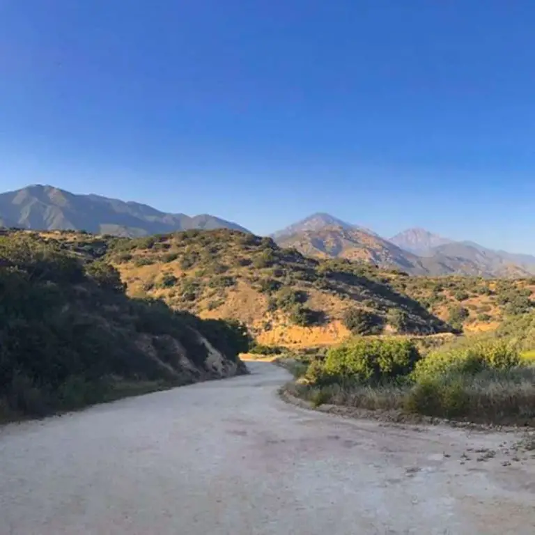
From the intersection of Torrey Pines Road and La Jolla Farms Drive, head southwest on La Jolla Farms Drive for 300 feet, then turn right onto La Jolla Farms Road. Stay on this road for about a mile until you see the trailhead on your left. Look for parking on the street.
The Trail
Ho Chi Minh Trail has been used by surfers to access the world-class surf breaks of Blacks Beach since the 1960s.
The trail presumably takes its name from the infamous jungle trail the Viet Cong used during the Vietnam War, a reference to the secretive nature of the La Jolla trail or maybe its challenging and jungle-like features.
The trail starts off between homes in the wealthy neighborhood of La Jolla Farms. Passing by the houses, it soon opens up to a steep canyon that the trail will follow all the way to the beach.
The canyon is covered in sage, buckwheat, cactus, lemonade berry and other coastal chaparral plants. At the top of the canyon, is the Salk Institute for Biological Studies, famed for its architecture. Across the canyon on the top of the bluff to the north is Torrey Pines Glider Port, where paragliders fly using the updrafts from the tall bluffs.
As the trail heads down into the canyon it bends southwest towards the ocean. Once you reach the bottom of the canyon, the trail begins to follow a small stream and the vegetation comes thicker with palms and anise lining the trail. Just as you reach the bottom, you’ll encounter a bridge made of a board, and it’s time to employ your balance beam skills.
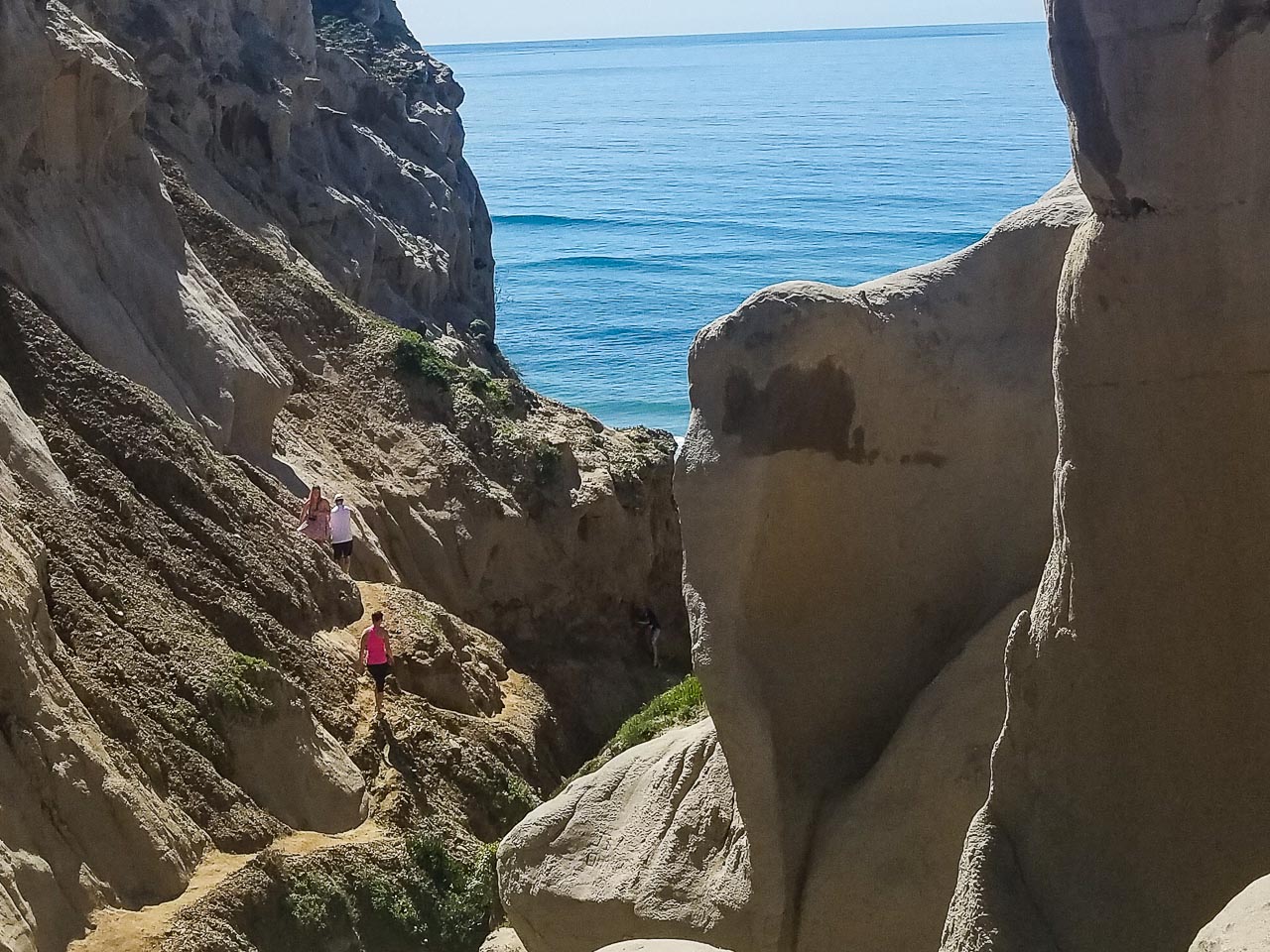
As you proceed towards the ocean, the bottom of the canyon becomes narrower and the trail follows a shelf along the stream. Soon you encounter the next major obstacle, as the trail descends through a tight sandstone slot.
The first time I hiked this trail, I was stymied on how to proceed for about 5 minutes before noticing the entrance to the slot. The sandstone in the slot has smooth steps of sorts carved into it from past hikers. Using those and pressing your hands against the sides, you can squeeze through this neat feature.
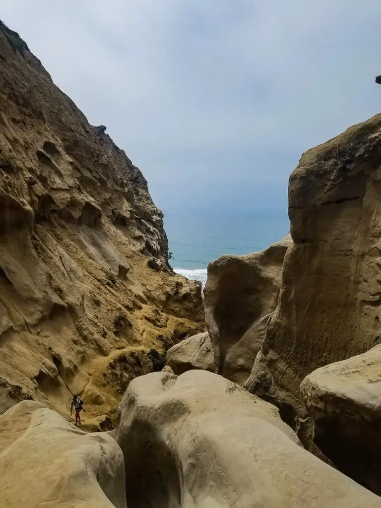
At the bottom of the slot the trail proceeds along the south side of the canyon. As the stream bed drops quickly towards the beach, the trail stays relatively level as it follows the canyon wall. As a result, the trail in places is high enough above the creek bed that a fall could cause injury.
At one point, the canyon wall bulges out and the trail bends to follow it. This is the sketchiest section of the trail. The footing is narrow, sloped and loose in places, and the trail a good distance above the creek bed. Proceed with caution – or don’t proceed at all, if you aren’t confident you can make it safely.
The trail then passes under a small waterfall and crosses the stream below the falls. The last section before the beach is a steep, slippery scramble assisted by a fixed rope.
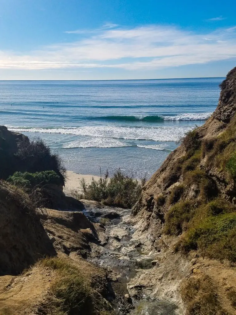
Once on the beach, you can explore south, towards La Jolla Shores, a more easily accessed stretch of beach popular among beachgoers, surfers, and sea kayakers. You’ll see the Scripps Oceanographic Institute pier in the distance.
Heading north, you’ll enter the part of the beach that’s managed by the state parks system, where many nude beachgoers hang out. This end of Blacks becomes Torrey Pines State Beach, which is managed by the state parks system.

When you are ready to head back, the quickest return route is back the way you came up Ho Chi Minh Trail. If you wanted to get in a longer hike, you could head south along Blacks Beach to the paved road that lifeguards use to access the beach with their Jeeps. This road will bring you back to the top of the bluffs to La Jolla Farms Drive, which you can follow north to the upper trailhead of Ho Chi Minh Trail and your vehicle (if you drove).