Kwaay Paay Peak Trail – Mission Gorge
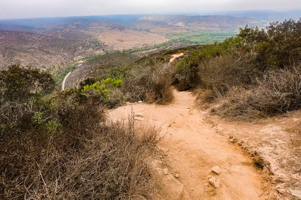
If you’re looking for a quick, heart-pumping hike with great views in San Diego, look no further than Kwaay Paay Peak Trail in Mission Trails Regional Park.
This steep 2.5-mile out-and-back route climbs 885 feet from Mission Gorge to the 1,194-foot summit of Kwaay Paay Peak. At the peak, you’ll be treated to terrific views of Mission Trails and the surrounding landscape, including the mountains to the east and downtown San Diego to the west.
Trail Details
Trail type: Out-and-back
Difficulty: Moderate
Length: 2.5 miles round trip
Elevation gain and loss: 885 feet, -885 feet
Trailhead Coordinates (East Trailhead): 32.840278, -117.036964
Location: Mission Trails Regional Park
Season: Year-round, but hot in summer
Getting to Kwaay Paay Peak Trailhead
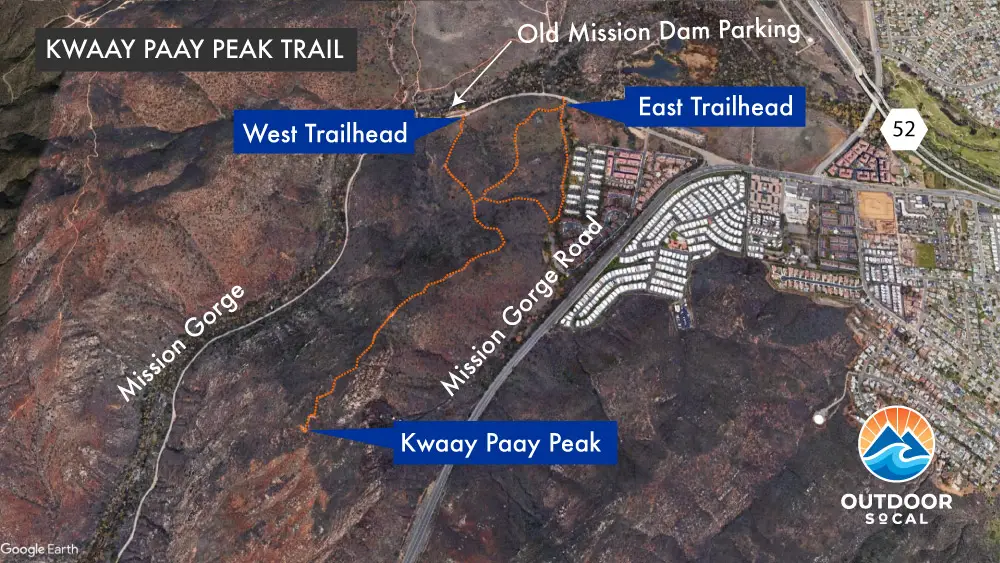
There are two potential trailheads for the hike for two entrance trails known respectively as Kwaay Paay Peak East Trail and West Trail. The trailheads are less than a quarter-mile apart and both start from Father Junipero Serra Trail, which runs through the park.
To get to the trailheads from Highway 52, take the Mast Boulevard exit near Santee and head east. Go 0.2 miles and turn right on West Hills Parkway. After 0.7 miles, turn right onto Mission Gorge Road, then go 2.4 miles and turn right on Father Junipero Serra Trail. The east trailhead is on the left in 0.3 miles. The west trailhead is another 0.3 miles ahead, where the oneway portion of Father Junipero Serra Trail ends.
The Trail
Kwaay Paay Peak stands proud on the southeast side of Mission Gorge, which is fitting since “Kwaay Paay” means “chief” in the language of the Kumeyaay people who called the area home for thousands of years prior to the European invasion.
The mountain is one of five distinct peaks in Mission Trails Regional Park. This is a terrific trail if you are short on time and want to get in a workout in a short amount of time.
The sweeping views from the summit are a worthwhile payoff for the steep climb. The trail is very exposed and offers little shade, which, to my mind, makes this an early morning or late evening hike on hike days. Or wait until the cooler months to tackle this one. Either way, bring plenty of water and sun protection.
There are two trailheads to choose from. The trailhead that you come to first when driving along Father Junipero Serra Trail makes for the full 1.25 miles to the peak. This is called Kwaay Paay Peak East Trail (Trailhead GPS: 32.840278, -117.036964).
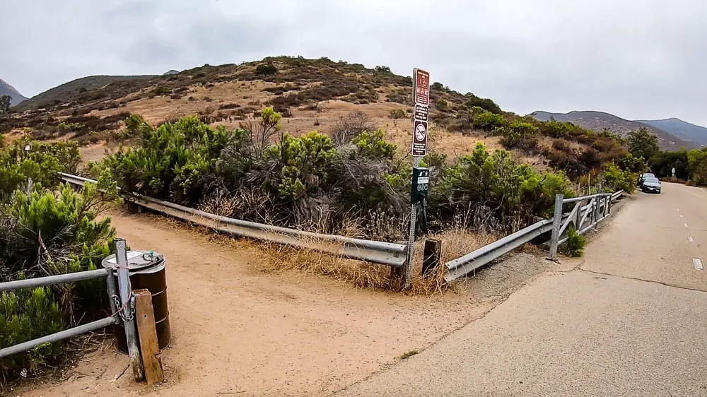
There is parking along the road. Soon after the trail starts it splits, with the left branch following along a housing development for a while before bending north. The right fork climbs up a steep rise before dropping down into a saddle and then climbing again. The two forks merge back together after less than half a mile.
Following the advice of a hiker I bumped into, I took the left fork. I wouldn’t recommend it. The noise and visual impact of the housing development takes away from the experience and the proximity to civilization means that a lot of people walk their dogs along this section — and not all of them clean up the mess. Take the right fork. With either fork, you’ll gain around 240 feet in elevations up to the merge.
A little past where the two forks of the east trail merge, another trail comes in from the northwest. This is the Kwaay Paay Peak West Trail, the alternative entrance trail that begins near the parking lot for Mission Trail Dam, where the one-way road through the gorge ends. If you enter via this trailhead, you shave about a quarter-mile off the hike to the peak. While steep and less well maintained, this trail has the advantage of being more isolated, with no houses spoiling the natural scenery or dog bombs to avoid.
Soon after the point where the east and west trails merge, the trail bends to the east before turning back southwest to climb steadily along the ridge towards the peak. In many places, rocks and wooden steps make for steep climbing. A little under a mile into the trip, you’ll come to a wide clearing, after which the trail climbs up a very steep set of switchbacks. You’ll gain about 250 feet of elevation in a little over an eighth of a mile, with places having a 43 percent grade. If you aren’t huffing and puffing in this section, you’re in much better shape than I am.

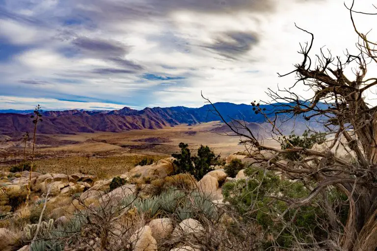
At the peak, there are lots of rocks to sit on to take in the view. To the north, you’ll see the other side of Mission Gorge and the north and south peaks of Fortuna Mountain. In the distance to the east are the Laguna Mountains and to the west, you can see downtown San Diego. A kiosk at the top gives some history of the area and Kwaay Paay Peak.
About Mission Trails Regional Park
Located about 8-miles northeast of downtown San Diego, Mission Trails Regional Park encompasses more than 8,000 acres of mountainous open space that is popular among hikers, mountain bikers, and rock climbers. The San Diego River flows through Mission Gorge, offering a rare year-round source of flowing water in this arid landscape. Despite being surrounded by suburban neighborhoods, the park’s coastal sage, chaparral, and riparian ecosystems are home to numerous animals, including bobcats, coyotes, deer, and many native lizard and bird species. The visitor’s center, located at the western end of the gorge, offers great information on the park’s human and natural history.


