Canyon Sin Nombre: Off-Road Trail Guide
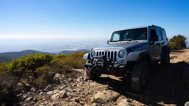
Canyon Sin Nombre is an easy-to-moderate 4-mile off-road route located on the western edge of Anza-Borrego Desert State Park in San Diego County, California.
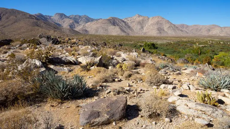
This scenic desert drive leads you through towering mudstone walls, winding slot-canyon passages, and broad sandy washes carved over millennia. The route is accessible to most high-clearance vehicles and offers a dramatic introduction to Anza-Borrego’s geology, making it a favorite for all levels of off-roaders.
The trail also connects to the larger Vallecito Creek and Carrizo Badlands route network, allowing adventurous drivers to extend their trip deeper into the park’s rugged backcountry.
Trail Details
| Trail Type | Out-and-back (can connect to Arroyo Tapiado & Vallecito Creek) |
| Difficulty | Easy to Moderate |
| Length | ~4 miles (one-way) |
| Trailhead Coordinates | 32.8299840, -116.170324 |
| Location | West side of Anza-Borrego Desert State Park, San Diego County |
| Season | October–May (summer heat can be extreme) |
| Information Number | Anza-Borrego Visitor Center: 760-767-4205 |
Getting to Canyon Sin Nombre Trailhead
From Interstate 8, take Exit 89 the Ocotillo exit. Head north on S-2 (Imperial Highway) for approximately 13 miles. Look for a small brown sign labeled Canyon Sin Nombre on the right side of the highway.
Turn onto the unpaved access road, which quickly drops into a wide wash. This is the start of the trail. Parking for hikers is available near the entrance, but off-road drivers can continue straight into the canyon. No permits are required, and the route is well-traveled and easy to follow.
The Trail
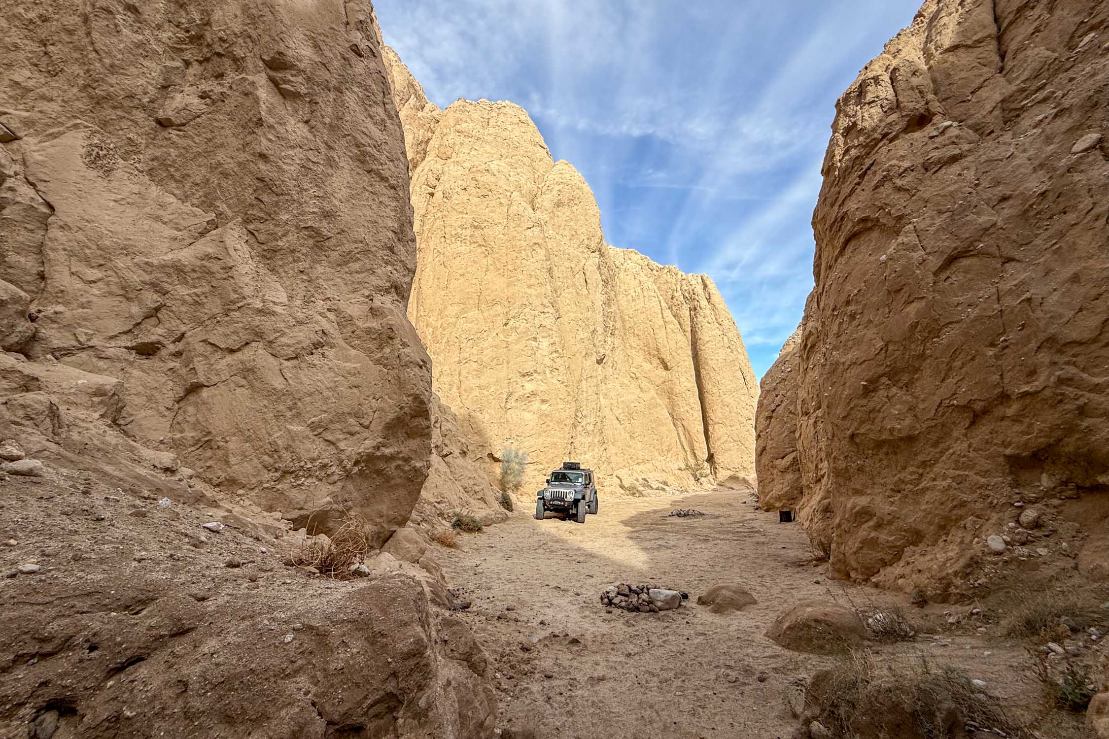
The trail begins in a broad sandy wash framed by low hills before narrowing into the canyon proper at around the three-quarter mile mark. As you enter the main gorge, vertical mudstone cliffs rise on both sides, an early sign of the striking geology to come. The terrain consists mostly of firm sand with occasional gravel and mild ruts, making it accessible to most high-clearance SUVs and 4WD vehicles. Drivers should proceed slowly. If it has rained significantly recently (within the past 2-3 days), a high-clearance 4WD with aggressive tires will help prevent getting stuck in mud.
The trail winds through the sandy canyon, which is fairly barren besides some scrub brush. At different points along the left side of the canyon, there are side trails into narrow canyons (tight slot canyons in some cases) that are fun to explore on foot. The entrances to two of these are located at GPS coordinates: 32.8437147, -116.154380 and 32.847692, -116.154501, respectively.
Past the slot sections, the canyon opens into a wider wash, offering sweeping views of the Carrizo Badlands. The route continues north until it intersects with Vallecito Creek Wash, a major backcountry corridor that connects to Arroyo Tapiado (home to the region’s mud caves) and other Anza-Borrego routes.
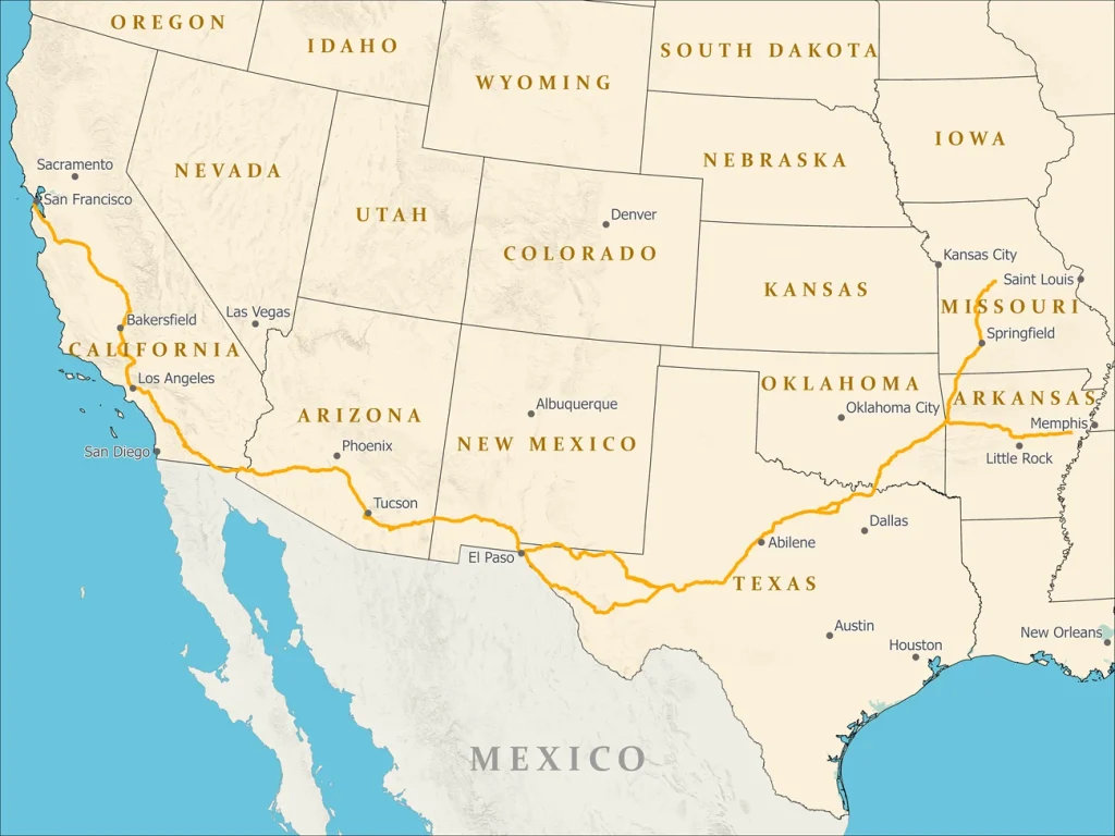
One of the nearby points of interest along Vallecito Creek is Palm Spring, once a stop on the Butterfield Stage Route, which used to run from Saint Louis and Memphis to San Francisco..
You can continue exploring these areas, or turn around near the wash junction and retrace the route back through the canyon.
Note that you can’t rely on cellular signals in this area, so you will want to have paper maps or maps in phone apps downloaded for offline use. The spurs in the Vallecito/Arroyo Tapiado network can be tricky to spot, and having some kind of satellite navigation app can be very helpful. I typically use a combination of Gaia GPS and OnX.
Nearby Camping
Canyon Sin Nombre offers excellent dispersed camping opportunities along the broad washes outside the narrower canyon sections. These sites provide level ground, wind protection from surrounding hills, and exceptional stargazing typical of the Anza-Borrego region. Visit our Anza-Borrrego camping guide for information and regulations on dispersed camping in the area.
For established camping with amenities, Bow Willow Campground (5 miles south on S-2) and Mountain Palm Springs Campground (7 miles southeast) provide picnic tables, shade structures, and vault toilets. Both are first-come, first-served. Agua Caliente Campground, a developed campground with bathrooms, hot spring pools, and a range of site types, from tent-only to partial hookups, is located about 15 miles north on Route S2.