Palm Springs Hiking Guide
Palm Springs is a desert oasis renowned for – well, yes, golf – but also its stunning landscapes and diverse hiking trails that cater to all levels of outdoor enthusiasts. With the San Jacinto Mountains as a backdrop, hikers can enjoy panoramic views, unique rock formations, and the vibrant desert flora and fauna.
Palm Springs offers a range of trails that highlight the natural beauty of the Coachella Valley and surrounding mountains. Federal and state agencies or local Native American tribes manage the trails.
Indian Canyons Trails
Located near Palm Springs, the Indian Canyons—comprising Tahquitz Canyon, Palm Canyon, Andreas Canyon, and Murray Canyon—are a treasure trove of natural beauty and cultural history. Managed by the Agua Caliente Band of Cahuilla Indians, these canyons offer several hiking trails ranging from easy walks to more challenging routes, all set against a backdrop of striking rock formations, lush palm oases, and seasonal streams.
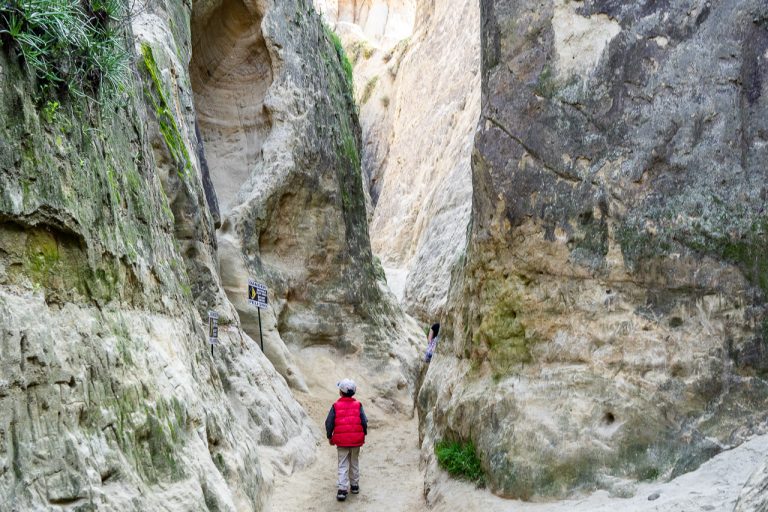
Tahquitz Canyon
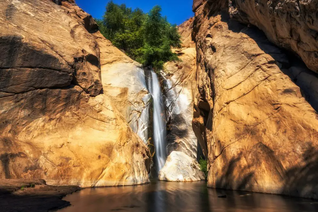
This picturesque hike features a 1.8-mile loop that leads you through the stunning canyon, showcasing a beautiful waterfall and ancient rock art. The moderate trail is shaded by lush vegetation and offers interpretive signs along the way, making it perfect for families.
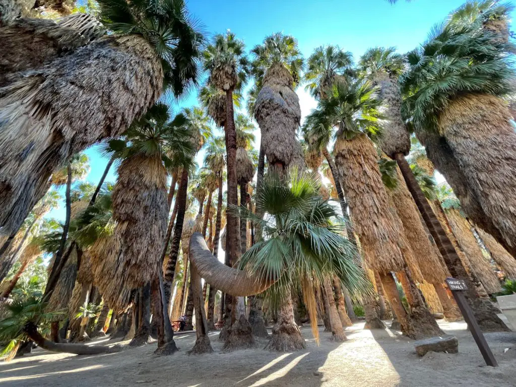
Andreas Canyon

Located within the Agua Caliente Indian Reservation, this easy 1.5-mile loop trail takes you through a palm oasis and stunning rock formations. Enjoy the tranquil setting as you meander along the creek, surrounded by native plants and wildlife.
Palm Canyon Trail
One of the most popular hikes in the area, the Palm Canyon Trail is a 3-mile round-trip journey that leads you through a stunning grove of California fan palms. The trail offers a moderate climb and provides beautiful views of the canyon walls and the surrounding landscape.
Murray Canyon Trail

This moderate 3-mile round-trip hike takes you through lush desert scenery, leading to a tranquil oasis. Look out for wildlife along the way, including various birds and possibly even a bighorn sheep. The trail culminates in a serene spot perfect for a picnic.
Other Palm Springs Trails
In addition to the trails located in Indian Canyons, Palm Springs offers many other hiking options in the mountain ranges on either side of the valley as well as within the Coachella Valley itself.
Bump and Grind Trail
A local favorite, this 4-mile loop offers a moderate workout with rewarding views of Palm Springs and the San Jacinto Mountains. The trail features a mix of steep sections and flat areas, making it great for those looking for a good hike close to the city.
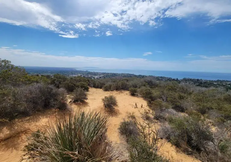
Coachella Valley Preserve
For those looking to explore a unique desert ecosystem, the Coachella Valley Preserve offers several trails, including the 2.5-mile Windy Point Trail. Enjoy beautiful views of the windmills, the Salton Sea, and diverse wildlife in this protected area.
Chuckwalla Loop Trail
This scenic loop offers hikers a moderate 4.4-mile trail through the Chuckwalla Mountains, providing stunning views and the chance to see unique desert wildlife along the way.
Trailhead coordinates: 33.661505, -116.170374
Cathedral Canyon Trail
This 2-mile trail leads you through a picturesque canyon, known for its towering rock formations and vibrant desert flora. It’s an excellent choice for a quick escape into nature.
Trailhead coordinates: 33.712221, -116.575785
Mike Schuler Trail
A relatively easy 3-mile loop, this trail is perfect for families and offers beautiful views of the surrounding mountains and valleys.
Trailhead coordinates: 33.793261, -116.527204
Herb Jeffries Trail
This moderate 3.5-mile loop trail winds through diverse terrain and offers several scenic viewpoints along the way.
Trailhead coordinates: 33.827573, -116.511088
Gabby Hayes Trail
A shorter option at 1.5 miles, this trail is ideal for a quick hike while still offering beautiful views of the Palm Springs area.
Trailhead coordinates: 33.813645, -116.583491
Homestead Trail
This moderate 3-mile trail takes you through a variety of desert landscapes, showcasing the unique flora and fauna of the region.
Trailhead coordinates: 33.757823, -116.640094
Eisenhower Mountain Trail
A more strenuous 5.2-mile hike, this trail leads you to the summit of Eisenhower Mountain, offering panoramic views of the Coachella Valley.
Trailhead coordinates: 33.754663, -116.599112
Randall Henderson Loop Trail
This 2.5-mile loop offers a moderate hike with scenic views and the opportunity to see various desert plants and animals.
Trailhead coordinates: 33.835279, -116.503885
Hopalong Cassidy Trail
An easy 2.1-mile trail, this hike is perfect for families and leads through picturesque landscapes with opportunities to see local wildlife.
Trailhead coordinates: 33.849557, -116.546188
Art Smith Trail
A popular 5-mile out-and-back trail that provides beautiful views of the desert landscape, this hike is great for a full day of exploration.
Trailhead coordinates: 33.704189, -116.450832
Eagle Canyon Trail
This 2-mile trail is known for its stunning rock formations and beautiful canyon scenery, perfect for those looking for a short but scenic hike.
Trailhead coordinates: 33.680248, -116.586346
Bighorn Overlook Trail
Offering one of the best views in the area, this 2-mile out-and-back trail leads to a stunning overlook of the Coachella Valley.
Trailhead coordinates: 33.774046, -116.545241
Palm Springs Aerial Tramway to Mount San Jacinto State Park
Take a scenic tram ride up to an elevation of over 8,000 feet, where you’ll find an array of hiking options amidst stunning alpine scenery. The trails range from easy to strenuous, and you can enjoy breathtaking views of the valley below. A popular choice is the 11-mile round-trip trek to the summit of Mount San Jacinto.
Trailhead coordinates (at the top of the tram): 33.812904, -116.638484