Bluff Cove Trail
Bluff Cove Trail is a 1.1-mile out-and-back trail that brings you to terrific views of the Pacific Ocean and down to a rocky beach.
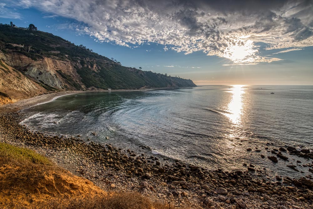
Located in Palos Verdes, California, the trail is popular for sunset hikes and a side spur offers access to Flat Rock Point a rugged point with many tidepools to explore at low tide.
Trail Details
| Trail Type | Out-and-back |
| Difficulty | Easy |
| Length | 1.1 miles |
| Elevation Gain/Loss | 129 feet/-129 feet |
| Trailhead Coordinates | 33.79762, -118.40656 |
| Location | Palos Verdes, California |
| Best Season | Year-round |
Getting to Bluff Cove Trail
The trailhead for Bluff Cove Trail is located on Paseo Del Mar about half a mile north of Surf View Park. Parking is available on the west side of Paseo Del Mar.
The Trail
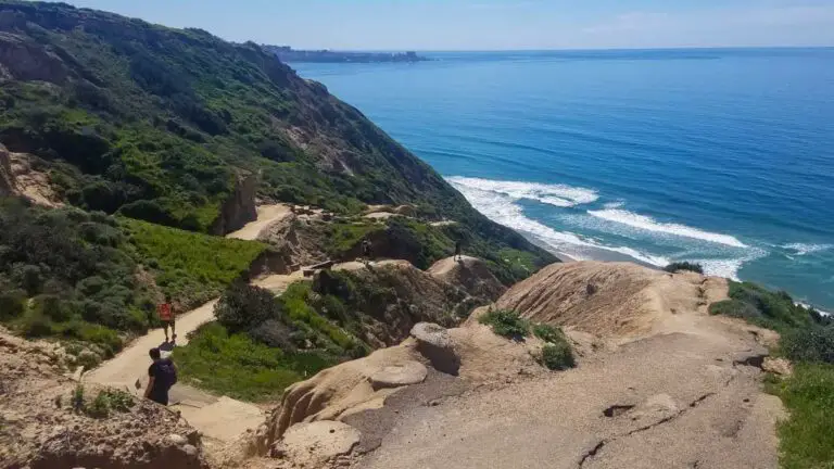
If you want to hike to escape the bustle of the city, the 117-mile out-and-back Bluff Cove is an excellent choice. It follows right along the coastal bluffs west of Palos Verdes Estates, so you can look out over the Pacific Ocean the whole way. This view makes for stunning sunsets, especially on clear or slightly cloudy days.
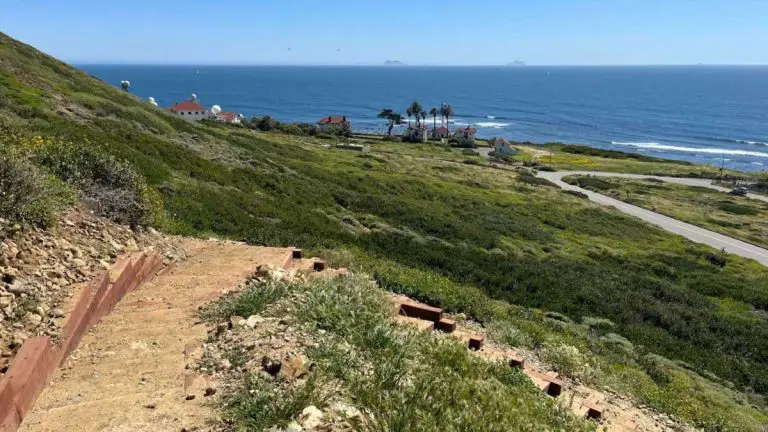
About 300 feet from the trailhead, the right fork brings you down a steep trail to Flat Rock Point, which marks the northmost boundary of Bluff Cove. For more adventurous types, exploring rocky Flat Rock Beach and the tidepools (during low tide) can be a great side trip.
If you stay left at the fork instead of going down to Flat Rock, the trail continues along the bluffs for a bit before descending to the rocky beach below Surf View Park. You can explore the beach and tidepools here before heading back.
If you are feeling ambitious and want to extend your hike, you can continue south along the beach and follow the coast for 1.5 miles to Lunada Bay. At the top of Lunada Bay is a point with a shipwreck – keep an eye out for the beached remains of the SS Dominator, a freighter that ran aground in 1961.