Mount Wilson Trail: A Historic Climb Through the San Gabriels

Mount Wilson Trail is one of Southern California’s oldest and most storied footpaths, climbing from the foothill town of Sierra Madre into the Angeles National Forest along a route built in the 1860s to access the summit of Mount Wilson. The trail reopened in early 2026 after a year of closure following the January 2025 Eaton Fire and the atmospheric river storms that followed, restored largely by the volunteer crews who have maintained it for generations. The full route to the summit remains incomplete because of upper-trail and Toll Road closures, but the lower trail to Orchard Camp is open and offers a demanding, scenic out-and-back that captures the essence of the San Gabriels.
Trail Details
| Trail Type | Out-and-back |
| Difficulty | Moderate to Strenuous |
| Length | ~7 miles round trip (to Orchard Camp) |
| Time | ~4–5 hours |
| Elevation Gain | ~2,200 feet |
| Best Season | Fall through spring |
| Location | Sierra Madre, Angeles National Forest |
Getting to the Trailhead
The Mount Wilson trailhead is located at the end of Mira Monte Avenue in Sierra Madre, a short walk from Kersting Court in the town’s small downtown. From the 210 freeway, exit at Baldwin Avenue and head north through the residential neighborhood until Baldwin meets Mira Monte. The trailhead gate is at the top of the street.
There is no parking lot at the trailhead. Hikers park along nearby residential streets, and posted restrictions should be observed carefully. No Adventure Pass is required for this trailhead, as the trail begins outside Forest Service land before crossing into the Angeles National Forest a short distance up.
Trail Overview
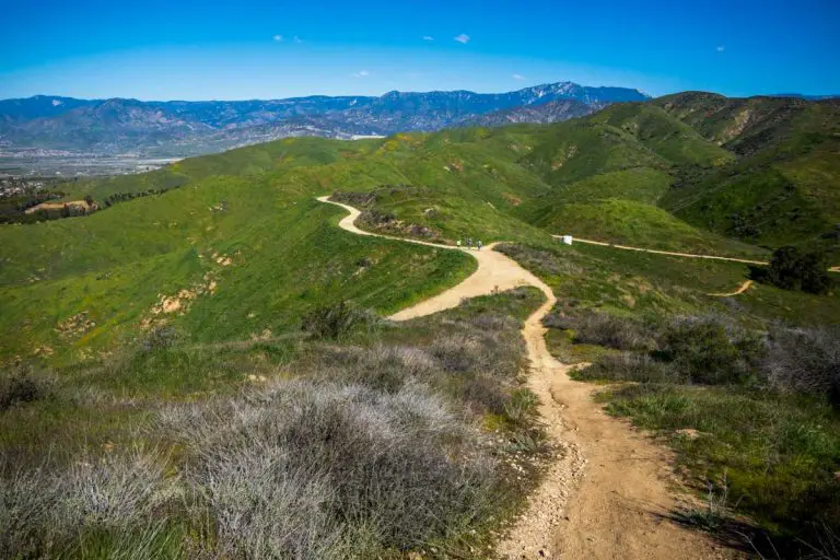
From the trailhead gate, the path climbs immediately and steadily, traversing the south-facing slopes above Sierra Madre. The trail is narrow, rocky, and exposed in many sections, with steep drop-offs into Little Santa Anita Canyon below. About 1.5 miles in, a signed junction marks the spur down to First Water, a shaded creekside spot that makes a popular shorter destination.
Beyond First Water, the trail continues climbing through chaparral and oak woodland toward Decker Spring and a series of switchbacks. The grade is consistent rather than punishing, but the cumulative elevation gain adds up quickly, and the lack of shade across long stretches makes pacing important.
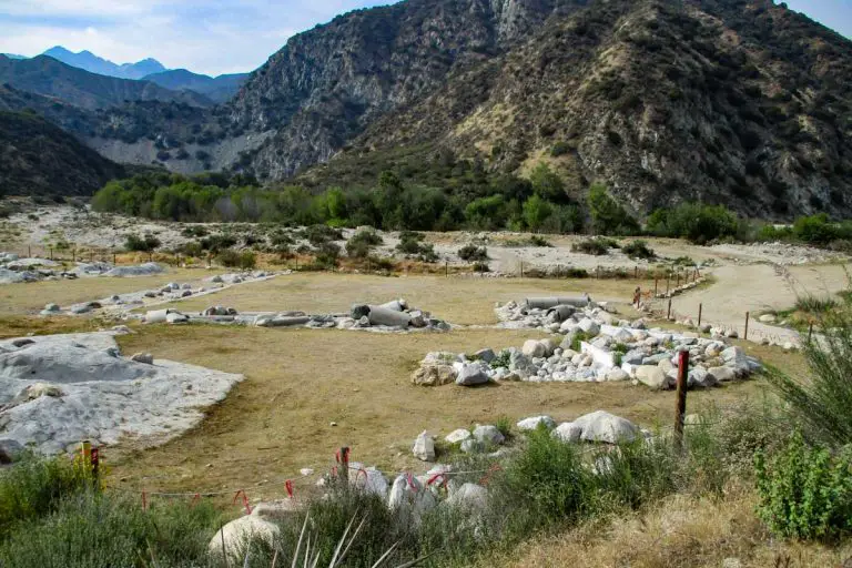
At roughly 3.5 miles, the trail reaches Orchard Camp, a flat clearing that once held an actual orchard and a small mountain resort during the trail’s heyday in the late 1800s and early 1900s. Today it serves as the standard turnaround point for hikers, with shaded benches and a sense of arrival. From here, the historic route continues another 3 miles to the summit of Mount Wilson, but the upper section remains closed pending repairs to the Mount Wilson Toll Road and connecting trails affected by the Eaton Fire.
Environment & Conditions
The Mount Wilson Trail is exposed, rocky, and steep enough in places that surefootedness matters. Trekking poles help, particularly on the descent, where loose decomposed granite can be slick. Recent storm cycles have caused additional erosion and scattered rockfall on previously repaired sections, so conditions can change between visits.
Summer temperatures on the lower trail can climb well into the 90s, and the south-facing aspect offers little relief. Most hikers prefer cooler months from late October through April, and early morning starts are advisable year-round. Water is not reliably available on the trail. Carry more than you think you need.
Trail maintenance on Mount Wilson Trail is performed entirely by volunteers organized through the Sierra Madre community, with no funding from the City or U.S. Forest Service. Donations to the Fletcher Trail Maintenance Fund directly support the ongoing work to keep the trail open.
Nearby Hiking Options
Bailey Canyon Trail, which traditionally pairs with Mount Wilson Trail for loop options through the Sierra Madre foothills, remains closed indefinitely due to Eaton Fire damage. Hikers looking for additional San Gabriel front-range options open in 2026 can explore Chantry Flat trails farther east in Arcadia, or head west toward the Mount Lukens area. Many of the closer alternatives—including Eaton Canyon, Echo Mountain, and Sam Merrill Trail—are part of the extended Eaton Fire closure expected to remain in place through December 2027.