11 Best Sunset Hikes in Los Angeles
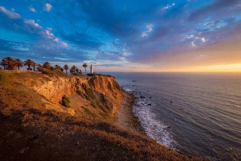
Hiking in the evening is an excellent way to avoid hot weather and crowded trails, and it’s also one of the best ways to catch a great view of the sunset.
Whether you want to enjoy the illuminated cityscape or watch the sun sink below the horizon of the Pacific Ocean, here are 11 of the best sunset hikes in Los Angeles.
The information in this guide is for informational purposes only. We use Gaia GPS for mobile devices and also bring high-quality printed topographic maps while in the backcountry, and recommend you do the same.
Ferndell to West Observatory Loop Trail
Located in Griffith Park, this easy 2.6-mile loop begins on the Ferndell Trail before meeting up with the Lower West Observatory Trail. If you start about an hour before sundown you’ll be able to enjoy the lush canyon on your way up and watch the sunset over Los Angeles from the viewing areas near Griffith Observatory. Once it’s dark you can head into the observatory to peek through the free public telescopes or simply enjoy the panoramic views of the city lights below. To complete the loop, head back on the Upper West Observatory Trail and keep an eye out for the iconic Hollywood sign on your way down.
Trailhead coordinates: 34.109392, -118.307691
Forrestal Reserve Loop
Set in Forestal Reserve near Rancho Palos Verdes, this 2.7-mile loop takes you through the hills overlooking the ocean. Although the hike presents a moderate level of difficulty with several inclines, there are also a few vista points and benches along the way if you need a quick break to enjoy the view. The lack of shade makes it an excellent choice for an evening hike, and if you time it right you’ll be rewarded with panoramic views of the sun setting over the Pacific Ocean. The gate to the parking lot is locked an hour after sunset, so be sure to park on the street if you plan on staying longer.
Traihead coordinates: 33.737982, -118.347663
Angel’s Point

Angel’s Point in Elysian Park is a great place to catch the skyline of Downtown LA backlit by the sunset, and the 0.6-mile out-and-back trail from Academy Road is short and sweet. You also have the option to drive up the hill to Angel’s Point Road, and from there it’s just a short walk to the vista. Once you’re at the top you’ll have views of Dodger Stadium and Downtown LA as well as the Hollywood sign and Griffith Observatory. If you stay after dark on a Friday during baseball season you’ll also get to see the Friday Night Fireworks set off at Dodger Stadium.
Trailhead coordinates: 34.079214, -118.243999
Runyon Canyon Trail
Runyon Canyon Park boasts some of the most popular hiking trails in Los Angeles, and there are several options of varying length and difficulty. Runyon Canyon Trail is a moderate 2.7-mile loop that’s a great option for a sunset hike because the path is wide and well-trafficked. It winds through the Santa Monica Mountains south of the Hollywood Hills, and there’s enough of an incline to make it a workout. Once you’re at the top, you’ll see several benches and picnic tables where you can sit and enjoy the expansive views of the city below.
Trailhead coordinates: 34.105331, -118.350926
Lonesome Pine Hike
The hike up to Lonesome Pine from Lake Hollywood Drive is a quick but strenuous out-and-back trail that’s a 1.6-mile round-trip. The trail’s namesake comes from the single pine tree standing at the summit. On your way up you’ll see sweeping vistas of the San Fernando Valley, and the setting sun behind the Santa Monica Mountains gives way to gorgeous views of the twinkling city lights below. Because the trail is steep, make sure to bring a good headlamp or flashlight if you’ll be hiking after dark.
Trailhead coordinates: 34.132111, -118.337829
Ascot Hills Trail
Located in East LA, Ascot Hills Park features rolling hills and city views that rival those from Griffith Park and Elysian Park, but with less crowded trails. The 2.1-mile Ascot Hills Trail is a loop that takes you around the perimeter of the park, where you’ll see many different wildflowers in the early spring. At the top of the trail, you’ll be able to see the setting sun illuminate the surrounding hills as well as the LA skyline to the southwest. The parking lot is locked at dusk, so park on the street if you’re staying for the sunset.
Trailhead coordinates: 34.070902, -118.188761
Bluff Cove to Trail
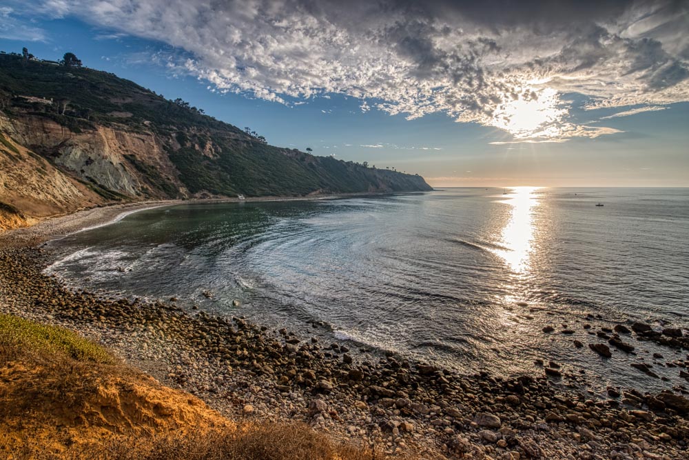
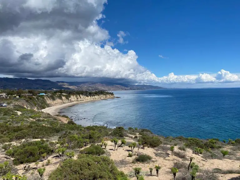
Bluff Cove Trail is a 1.1-mile out-and-back trail that brings you to terrific views of the Pacific Ocean and down to a rocky beach. Located in Palos Verdes, California, the trail is popular for sunset hikes and a side spur offers access to Flat Rock Point a rugged point with many tidepools to explore at low tide. If you are feeling ambitious and want to extend your hike, you can continue south along the beach and follow the coast for 1.5 miles to Lunada Bay. At the top of Lunada Bay is a point with a shipwreck – keep an eye out for the beached remains of the SS Dominator, a freighter that ran aground in 1961.
For more information, visit our Bluff Cove Trail guide.
Escondido Falls Trail
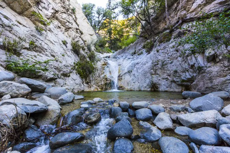
Set in the beautiful Santa Monica Mountains, the Escondido Falls Trail is a 3.7-mile out-and-back trail that leads up to the tallest waterfall in the mountains. The falls are fullest in the late winter and early spring after the rain, but the trail is accessible year-round. Start out early so that you have plenty of time to explore the falls while it’s light because the rocks can be slippery and the trail gets steeper near the end. When you’re heading back you’ll catch glimpses of Malibu below, and you can enjoy views of the sun setting over the Pacific Ocean.
Trailhead coordinates: 34.031711, -118.772639
Point Dume Trail
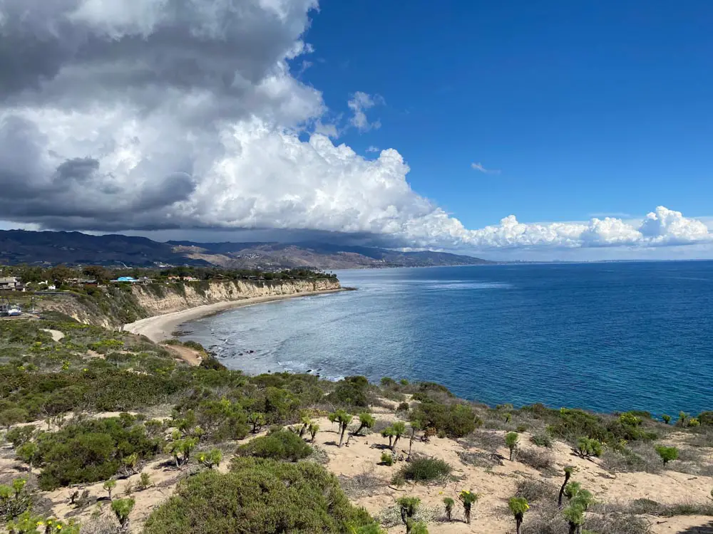
Located near Malibu, the 1.4-mile out-and-back Point Dume Trail offers unparalleled ocean scenery as well as stunning wildflower blooms in the spring. With only 347 feet in elevation gain, it’s a quick and easy hike with rewarding views. If you’re lucky you’ll see seals and dolphins in the water below, and on clear days you can see Catalina Island off in the distance. The sweeping views make it excellent for watching the sunset, and the trail is easy to navigate after dark.
For more information, visit our Point Dume hiking guide.
Los Liones Trail to Paseo Miramar Lookout
Although the famous Los Liones Trail in its entirety is 4.4 miles round-trip, you can stop at the Paseo Miramar Lookout for beautiful sunset views of the Pacific Ocean and Santa Monica, which makes it an easy 1.8-mile hike. On clear nights you’ll even be able to see the lights from the Santa Monica Pier and the lit-up Ferris wheel down the coastline. If you want a less challenging hike you can begin at the Paseo Miramar trailhead instead of the Los Liones trailhead, which is a quick 0.2 miles each way. See our guide to Los Liones Trail for details.
Signal Hill Trail
Located in inland Long Beach, Signal Hill Trail is a 1.7-mile family-friendly loop that’s stroller- and wheelchair-accessible. It offers great views of Catalina Island and the Pacific Ocean, the San Gabriel Mountains, the lights of Orange County, and the skyline of Downtown LA. The trail begins and ends at Hilltop Park, which has a panoramic vista and is the perfect place to watch the sunset. There are several benches and tables where you can sit to enjoy the view, and there are monuments and sculptures scattered along the trail as well. This trail is a suburban setting, so don’t expect a wilderness adventure. The trailhead coordinates provided here begin at Discovery Well Park.
Trailhead coordinates: 33.797559, -118.157887
For more information on terrific trails, check out our Los Angeles hiking guide. Also, see our guide to national parks near Los Angeles.


