Potato Chip Rock and Mount Woodson Hiking Guide

Potato Chip Rock is a popular hiking destination near San Diego, California, known for its distinctive, thin, and cantilevered rock formation. The hike to the rock is moderately challenging, with steep climbs and rewarding views from Mount Woodson.
There are multiple routes to reach Potato Chip Rock, including the 6.6-mile round-trip trail from Lake Poway and the shorter, steeper 3.75-mile round-trip hike from Highway 67. Hikers can expect a mix of dirt trails and paved road, with significant elevation gain. The trail type varies by route, with options for out-and-back hikes.
Trail Details
| Trail type | Out-and-back |
| Difficulty | Moderate to Difficult |
| Length | 3.75 – 6.6 miles round trip (depending on route) |
| Time | 2 to 4 hours |
| Elevation gain | Approximately 2,000 feet |
| Trailhead Coordinates | See below |
| Location | Mount Woodson, San Diego County, California |
| Season | Year-round |
| Information Number | 858-668-4772 |
Getting to the Trailhead
There are two primary trailheads for reaching Potato Chip Rock.
Lake Poway Trailhead (GPS: 33.006432, -117.013392): From San Diego, take I-15 North and exit at Rancho Bernardo Road. Turn right and continue onto Espola Road. Follow signs to Lake Poway Park, where paid parking is available. The hike from this trailhead is approximately 6.6 miles round trip and features dirt trails with significant elevation gain.
Highway 67 Trailhead (GPS: 33.006838, -116.955893): For a shorter but steeper hike, take Highway 67 north from Poway or south from Ramona. Park in the designated areas near 16310 Highway 67. This route follows the paved Mt. Woodson Road and is approximately 3.75 miles round trip. It offers a direct but steep ascent to the summit.
Trail Overview
The trail to Potato Chip Rock varies in length and difficulty based on the chosen route.

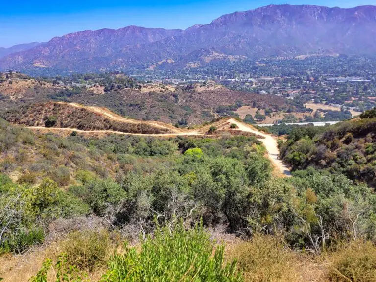
The Lake Poway route begins at the lake’s parking lot and follows a dirt trail with a steady incline. Hikers will pass through chaparral-covered hillsides, gaining elevation gradually before encountering steeper switchbacks as they approach the summit.

Along the way, there are panoramic views of Poway, the surrounding mountains, and glimpses of the Pacific Ocean on clear days. The last section of the hike is rugged, leading to the summit of Mount Woodson, where Potato Chip Rock sits just below the peak (GPS: 33.0092287, -116.974183).

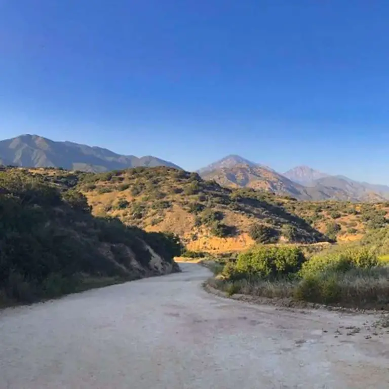
The Highway 67 route is a paved, direct ascent up Mt. Woodson Road. While this option is shorter, the continuous incline can be challenging. The route lacks shade, making early morning or cooler months the best hiking times. Despite its difficulty, this path is a quicker option for those looking to reach Potato Chip Rock with less mileage.

Once at Potato Chip Rock, hikers often queue to take photos standing on the rock’s edge, with dramatic drop-offs creating a striking visual effect. Despite its precarious appearance, the rock is stable, though caution is advised when climbing onto it.

Nearby Camping
Camping is not available at Mount Woodson, but nearby options include: