Ernie Maxwell Scenic Trail

Ernie Maxwell Scenic Trail is an easy 2.6-mile out-and-back route in the San Jacinto Wilderness near Idyllwild, California. Beginning at about 6,400 feet of elevation in Humber Park, the trail descends gently for 700 feet and crosses several seasonal streams. Families and beginning hikers will appreciate its gradual terrain, diverse tree cover, and impressive views of local landmarks, including Suicide Rock and Lily Rock.
Trail Details
| Trail Type | Out-and-back |
| Difficulty | Easy |
| Length | 2.6 miles |
| Time | 1–2 hours |
| Elevation Gain / Loss | +700 / -700 feet |
| Trailhead Coordinates | 33.764647, -116.687219 |
| Location | Near Idyllwild, California |
| Season | Year-round |
| Information Number | TBD |
Getting to Ernie Maxwell Scenic Trailhead
From downtown Idyllwild, take Fern Valley Road northeast for about 2.5 miles to reach Humber Park. The road ends at a paved parking area, which serves as the main trailhead for Ernie Maxwell Scenic Trail.


The Trail

We did this trail with our 4 year old son, who had no problem with the hike, as it is relatively flat. Starting at Humber Park, the path descends gradually through the forest, offering shade and cooler temperatures, especially in hotter months.

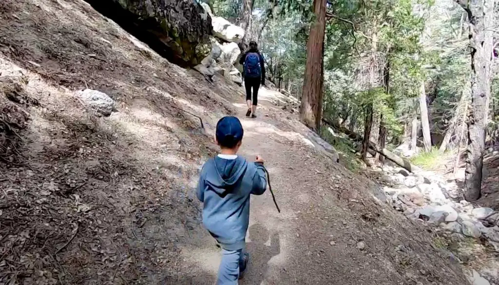
You’ll soon notice the variety of conifers lining the route—pines, cedars, and even oaks in the lower reaches—making this hike a good introduction to local botany. As you proceed, several seasonal streams cross the trail; during wetter months, small cascades and trickling creeks add to the serene atmosphere.

About halfway through, you’ll catch glimpses of Suicide Rock and Lily Rock, two iconic crags that attract climbers from around the region. These formations are especially striking against a clear sky, so pause for a photo or to enjoy the view.

Because the slope is relatively gentle, this trail suits newcomers and children who are learning to navigate uneven terrain. Keep in mind that while it’s considered easy, the higher elevation means weather can change quickly—pack a light jacket or layers.

The official endpoint is around 2.6 miles from Humber Park, though some hikers turn around earlier if time or energy is limited. Once you’re ready to return, simply retrace your steps uphill back to the parking area.
Dogs on leash are allowed, but mountain bikes are prohibited because the route lies within a wilderness area. In winter, snow and ice may cover the trail, so check conditions if you plan on visiting during colder months. For information on camping, check out our Idyllwild camping guide.
Below is a video that includes our experience on Ernie Maxwell and our trip to Idyllwild in general: