Anza Borrego Palm Canyon Trail Guide
Borrego Palm Canyon Trail, which starts at the Borrego Palm Canyon Campground, is one of Anza Borrego’s most easily accessed hiking trails and is a great introduction to the hiking in the desert park.
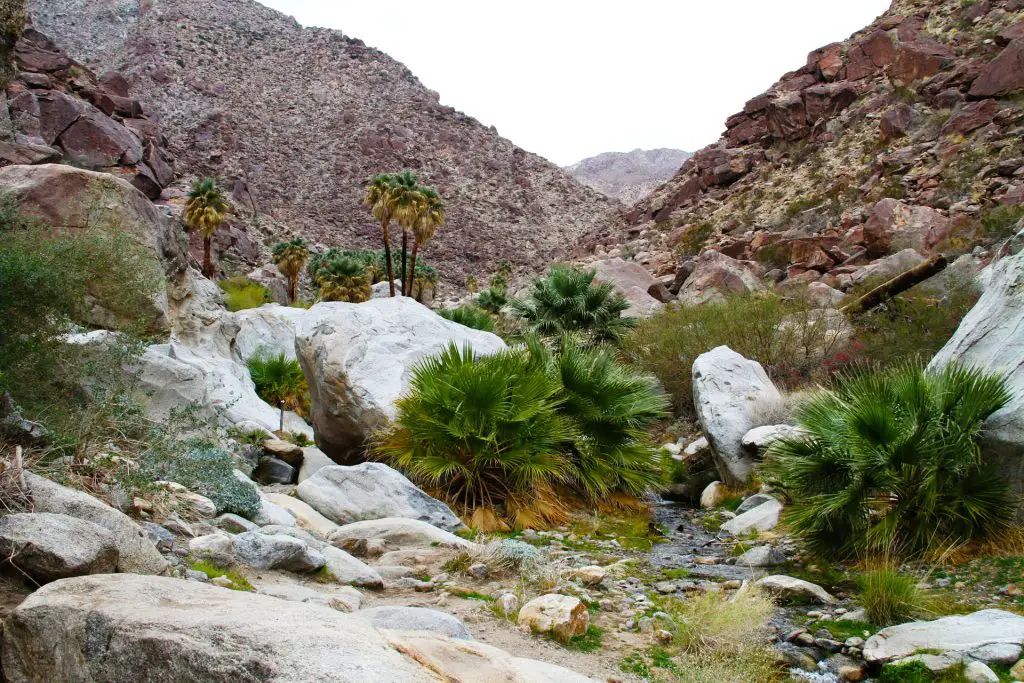
The canyon, located just west of the town of Borrego Springs, at the end of Palm Canyon Drive, shelters a surprisingly lush grove of palm trees fed by a mountain stream.
Trail Details
- Trail type: Out-and-back
- Difficulty: Easy/Moderate
- Length: 3 miles round trip
- Elevation gain and loss: 450 feet, -450 feet
- Trailhead Coordinates: 33.270331, -116.418186
- Location: Anza-Borrego Desert State Park
- Season: October – May
Getting to Borrego Palm Canyon Trail
The trailhead is located just west of the town of Borrego Springs, in Anza-Borrego Desert State Park. The trail starts in Borrego Palm Canyon Campground. To get there from Borrego Springs, take Palm Canyon Drive west until it terminates at the west end of the campground. pass through the campground and find parking at the far west end (closest to the mountains). The trail starts near the public restrooms and the big parking lot.
The Trail
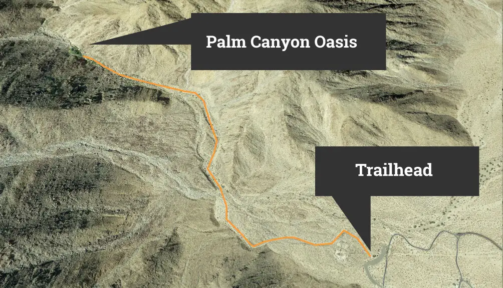
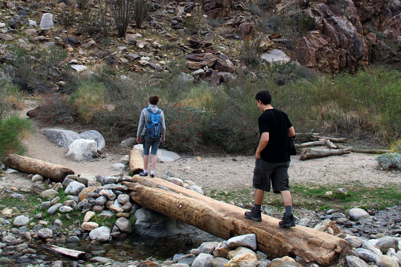
From the trailhead next to the state park parking lot, it’s a relatively mellow, 1.5 mile hike up the canyon to the oasis. The trail climbs a total of 450 feet. Set aside at least two hours and remember to bring lots of water. At the trailhead, there is a box that typically contains pamplets that explain some of the history, geology and flora and fauna of the area along the hike.


Like much of the park, exploring Borrego Palm Canyon feels a bit like walking on Mars — if the red planet was populated by many species of remarkable desert plants and animals. The trail winds through large builder piles and past dramatic geological formations. Many of the rocks have a rusty patina known as desert varnish.
Plants along the trail include desert lavender, ocotillo, cholla and beaver tail cacti (keep clear of the thorns) and California fan palms, which form the oasis at the apex of the hike and are the only palm species native to California. You may also encounter hummingbirds, coyotes and quail, among many other creatures that call the desert home. If you’re really lucky, you might even spy a Peninsular big horn sheep scrambling around on the canyon walls.

The trail follows a desert wash that fills during heavy rains, particularly after monsoon storms in July and August, when clouds from the Sea of Cortez move north. Keep an eye on the weather and avoid entering the canyon during or after heavy rains.
Don’t forget to pay the day-use fee for the parking area — the rangers have the authority to slap you with several hundred dollars in fines. Also, its worth checking with the nearby Anza Borrego visitors center (760-767-4205) to ensure the trail is open, as damage from flash flooding has resulted in closures in the past.
For more information on Anza Borrego, check out our Ultimate Guide to Anza Borrego Desert State Park We’ve also created a printable version of the Anza Borrego guide, which comes in handy in the many location in the park were mobile phones can’t pick up a cell tower signal.
We also recommend the Wilderness Press Map of Anza Borrego ($8 on Amazon), a waterproof map that highlights many trails and points of interest in the park.
If you enjoy Borrego Palm Canyon Trail, another relatively easy hike in Anza Borrego is the Wind Caves Trail, located in the eastern portion of the park, a few miles from Ocotillo Wells.