Kagel Mountain Trail Guide
Kagel Mountain Trail is a moderate length and difficulty trail located in Angeles National Forest in the Los Angeles River Ranger District.
The 6.2-mile trail has grown in popularity over the years and as it is centered around Kagel Mountain, the ultimate reward of the hike is the stunning views that can be seen from the summit.
The hike can be completed any time of year but spring is recommended as this offers a greater level of comfort.
Trail Details
| Trail Type | Combination |
| Difficulty | Moderate |
| Length | 6.2 miles |
| Elevation Gain/Loss | 1000 feet/-1000 feet |
| Trailhead Coordinates | 34.344613, -118.349489 |
| Location | San Gabriel Mountains, Angeles National Forest |
| Best Season | Year-round; spring recommended |
Getting to Kagel Mountain Trail
Getting to Kagel Mountain Trail is fairly straightforward. For those who prefer to rely on GPS technology, the address ‘Kagel Mountain, California, 91342, United States’ should be entered in order to take you to the Dillon Divide route trailhead.
Given the nature of the route, the surroundings are obviously suburban so be sure to follow the signs to avoid getting lost. The area is quite heavily signposted as the popularity of the trail has grown.
The information in this guide is for informational purposes only. We use Gaia GPS for mobile devices and also bring high-quality printed topographic maps while in the backcountry, and recommend you do the same.
As always, if driving, following the GPS instructions is the quickest and most convenient way to ensure you don’t get lost in whichever part of Los Angeles or the wider California area you are coming from as the GPS location will take you directly to the trailhead. You should be aware that there are numerous trail routes but by far the most popular is via Dillon Divide.
If you’re coming from Central Los Angeles; from I-210 take the Foothill Blvd, followed by a quick left on Osborne St., and follow it for around 7 miles, merging onto Little Tujunga Canyon Road, which doesn’t require any turns.
From the 14 Freeway, take the Sand Canyon Road exit then turn left on Soledad Canyon Road and take the first left on Sand Canyon Road. Follow it 10.5 miles – again merging onto Little Tujunga Canyon Road. The metal gate you will see marks the point where you must stop and find parking, details of which are below.
Parking at Kagel Mountain Trail
Given its somewhat unorthodox location, parking at Kagel Mountain Trail is limited. You should note that for ‘official’ parking at this destination, a National Forest Service Adventure Pass is required for parking or your vehicle will likely be towed as wardens do check the area. The passes are $5 per day or $30 for the year and can be purchased very easily online.
After following the directions above, you should find yourself at the Dillon Divide route and find parking on the left side of the road by the metal gate. This is the designated parking spot for this route and spots are usually available – depending upon the time of year/day you go. The trail is growing in popularity and parking is limited but you should be fine. You should make sure that your National Forest Service Adventure Pass is valid and visible to avoid issues.
The Trail
As one of the perhaps lesser-known trails in the Angeles National Forest, Kagel Mountain Trail, which is accessible in the Little Tujunga Canyon section, is a real delight and one of the best-kept secrets of the area.
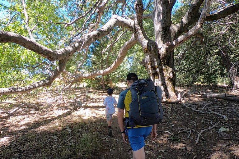
The hike itself is easy to moderate and features a 1,000-foot elevation gain on a fire road with breathtaking views and an opportunity to shut yourself off from the rest of society.
As above, the trailhead itself picks up at the Dillon Divide on Little Tujunga Canyon and climbs steadily making its way through the mountains and eventually leading to the mountain peak after a hike of around 1 and a half hours (one way).
The hike itself is well maintained and is certainly safe, save for not paying attention to your surroundings. You are hiking mountains so you should be aware of using safety measures to keep yourself and your party safe and wear appropriate footwear.
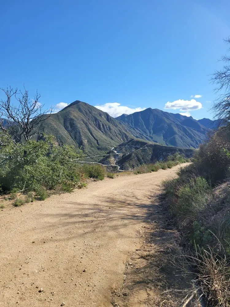
As you probably anticipated, the true beauty of this trail lies not the trail itself but the surrounding mountain ranges. The trail can at times feel all-encompassing as you are surrounded by these beautiful mountains which, depending on your vantage point offer stunning views of neighboring mountain ranges or a fuller view of California from above that is truly special to experience.

In terms of animals, dogs are certainly welcome on the trail and it is unlikely that you will encounter many other dog walkers as the trail is never that frequently populated and quite spread out. However, dogs must be on a leash at all times due to the nature of the hike and the elevation and drops that line the trail so safety is definitely exercised here.
Mountain biking is also a common theme of this trail and it is encouraged but bikers should be confident in their ability to navigate the trail and exercise caution throughout.
Eventually, the trail gains the ridgeline and you are off to the summit of Kagel. One of the really interesting things about this mountain trail is that it is often frequented by thrill-seekers who use it as a vantage point to launch themselves into the sky using a hand glider. This is a very common occurrence here and it is probable you will see a hand glider at some pointer which is really cool.
Much of the glorious natural wonders you will see on this trail comes in the form of magnificent trees and other nature, although it is not uncommon to encounter snakes on this trail so be sure to keep an eye out.
Given its elevated location, you may also see birdlife with many flora and fauna spotted by previous hikers although we did not have the pleasure of seeing any ourselves.
The ultimate reward comes at the end of this hike – with stunning views from atop of Kagel Mountain itself that are really to be seen to be believed. On a clear day, it offers stunning views far and wide.
Overall this is a fantastic hike that is understandably growing in popularity but is still reclusive enough to be enjoyed as if it was your own secret. The hike itself isn’t too taxing and the payoff with the views is really a joy to behold so make sure you get yourself over to Kagel Mountain Trail and get this one ticked off your list!
Hikers should note that this trail guide assumes taking the trail from the much more popular and well-used trail via Dillon Divide. The trail via Beeli Goat Trail – which also leads to Kagel Mountain Trail – is much less popular and as a result is not well maintained and involves much more climbing.
The trail via Beeli Goat Trail is much more challenging and hence is only recommended for experienced hikers. This trail guide is via the standard Dillon Divide route.