Torrey Pines Hiking Guide
So you want to find the best Torrey Pines hike? Take your pick, they are all amazing. Every trail in Torrey Pines State Natural Reserve offers spectacular views of the San Diego beaches, coastal bluffs, and the Pacific Ocean.
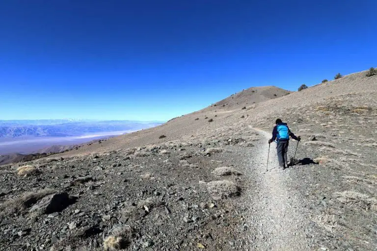
When you hike the Torrey Pines, it’s easy to forget you’re just minutes away from the center of America’s sixth-largest city. The 2,000-acre reserve offers a network of eight miles of hiking trails along the Pacific coast that wind through sage and cactus scrubland.
A remnant of the coastal sage scrub that used to cover the coast of Southern California prior to European settlement, Torrey Pines is also home to the rarest tree in the United States, Pinus torreyana, found only here and on the Channel Islands. It’s not uncommon to spot pods of dolphins and whales from the park’s high overlooks.
The information in this guide is for informational purposes only. We use Gaia GPS for mobile devices and also bring high-quality printed topographic maps while in the backcountry, and recommend you do the same.
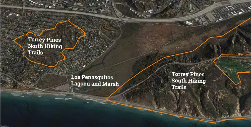
The reserve is split into two distinct sections, separated by a large lagoon and marsh. To the south of the Los Penasquitos Lagoon is the Ellen Browning Scripps Natural Reserve.
Northeast of the lagoon is a less-trafficked area of the reserve known simply as The Extension. Both areas offer a network of hiking trails. You’ll find detailed guides to the trails below. If you prefer to get the info via video, check out this video I put together:
Getting to Torrey Pines State Natural Reserve
South Hiking Trails: Ellen Browning Scripps Natural Preserve
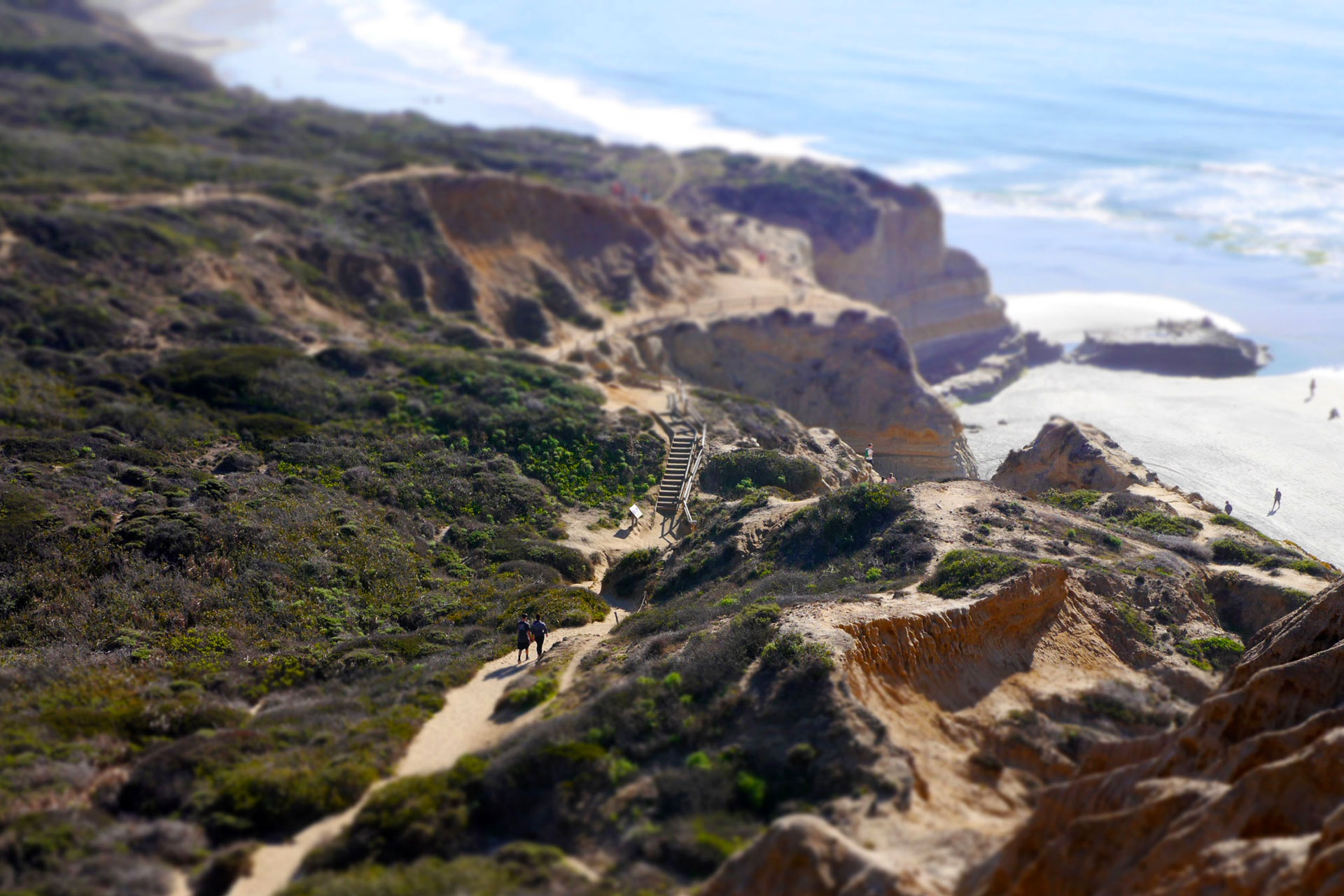
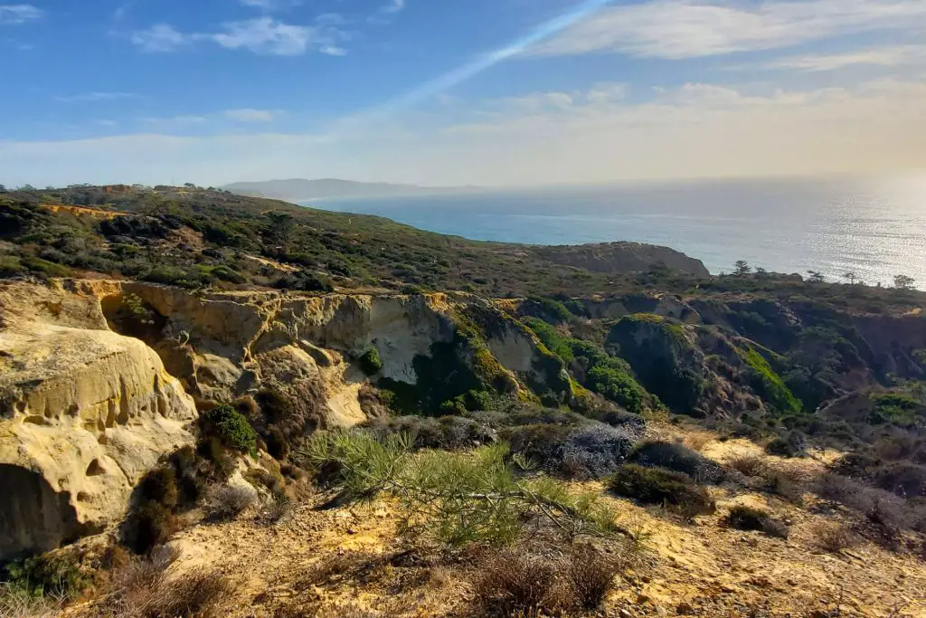
The most popular hiking area in Torrey Pines is the Ellen Browning Scripps Natural Preserve, the southmost portion of the reserve, defined by its tall ocean bluffs and panoramic views. This portion of the reserve offers the most hiking trails, beach access and is the most popular with visitors.
A common way to explore this section is to enter the reserve from North Torrey Pines Road and drive up the hill to the upper parking area, after paying the $10-$25 day-use fee, then hike down the bluffs towards the ocean. (If you plan to visit California State Parks on a regular basis, it’s worth considering the Explore Pass)
The GPS location of the entrance for this portion of the park is: 32.928692, -117.259582
Hikers can also explore this section of the reserve by parking at the entrance lot on the south side of Los Penasquitos Marsh, next to the ranger booth, and hiking up the road to the upper trailheads. It’s also possible to hike south along the beach from the lower parking lot, then hike up into the trails at the terminus of Beach Trail.
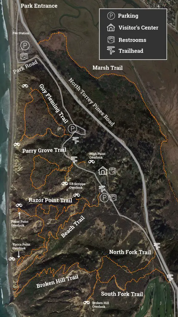
1) Guy Fleming Trail
Type: Loop
Length: .8 miles
Difficulty: Easy Trailhead GPS: 32.922923, -117.255444
Guy Fleming Trail is a quick and easy Torrey Pines hike with spectacular views. It’s the first trailhead you come to as you head up the park road from the ranger booth towards the visitors center. If you’re driving, you can park at the small gravel parking area on the right, just after a sharp right bend in the steep road. The trailhead is marked by a sign a few yards up the road from the parking area.
For more information, check out our full guide to Guy Fleming Trail.
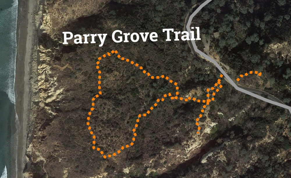
2) Parry Grove Trail
Type: Loop
Length: 1.3 miles
Difficulty: Easy/Moderate Elevation Gain: 150 feet
Trailhead GPS: 32.921446, -117.255178
Parry Grove Trail is fairly similar to Guy Fleming Trail, an elevated loop hike that brings you partway down the coastal bluffs overlooking the Pacific Ocean. This hike also offers panoramic views of the ocean and the San Diego coastline to the north and south. Parry Grove does have one unique feature that distinguishes it from the other Torrey Pines hikes, a long, steep stone staircase (118 steps to be exact) that brings you from the entrance trail to the loop portion of the trail.
The trail also gives you a view–from the EB Scripps Overlook at the terminus of the spur trail that begins at the top of the stone staircase–of a dramatic canyon that cuts through the center of the park.
3) Beach Trail
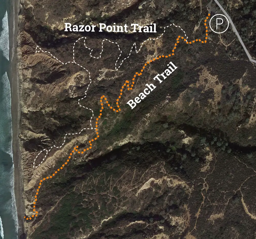
Type: Out-and-back or loop
Length: 1.5 miles (2.4 miles as a loop)
Difficulty: Easy/Moderate
Trailhead GPS: 32.919936, -117.252857
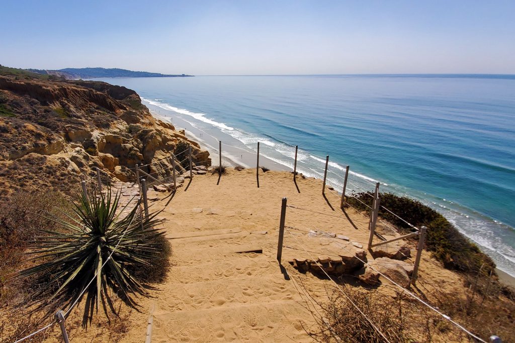
The Beach Trail is our favorite Torrey Pines hike, as it combines stunning views of the San Diego coastline and La Jolla with interesting terrain and access to Torrey Pines State Beach.
The out-and-back hike starts at the parking lot across the park road from the visitor’s center and drops 300 feet to the beach. The hike begins in a grove of Torrey pines, then opens up into tree-less coastal chaparral as you descend. On the way down the hill, you’ll pass Red Butte, a striking geological formation that is worth a look and fun to climb.
4) Razor Point Trail
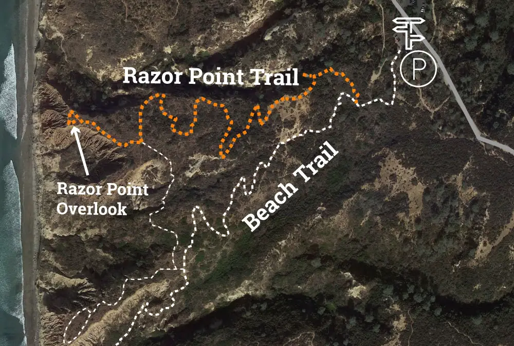
Type: Out-and-back
Length: .5 miles
Difficulty: Easy
Trailhead GPS: 32.919936, -117.252857
Razor Point Trail is a Torrey Pines hike that starts at the same trailhead as the Beach Trail outlined above After a couple of hundred yards, the trail splits, the left fork staying the Beach Trail and the right fork becoming Razor Point Trail.
The trail will split four more times on the way to Razor Point overlook. The first of the right forks leads quickly to an overlook–continue left to stay on the main trail. Stay right at each of the other three forks to get to Razor Point overlook, which looks out of jagged rock formations to the Pacific Ocean.
Razor Point Trail is less traffic than its neighbor, Beach Trail, and if you’re not looking to go all the way to the beach, this can be a less crowded alternative.
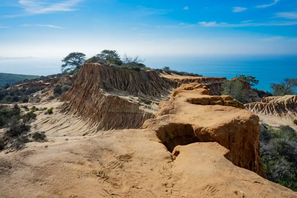
5) Broken Hill Trail
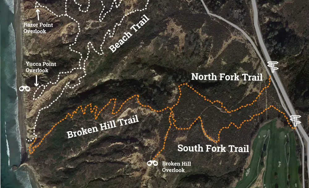
Type: Out-and-back
Length: ~1.25 miles
Difficulty: Easy/Moderate
Trailhead GPS (North Fork Trail): 32.916297, -117.247751
Broken Hill Trail is one of the least traveled of the Torrey Pines hikes, as the trailhead(s) is the furthest from a parking lot. The extra bit of walking pays off if you’re looking for a bit more seclusion.
It also brings you to some terrific vistas, including the Broken Hill Overlook, definitely one of the highlights of the park. Be careful at the overlook, as of this writing, there are no fences to keep you from walking off a cliff. Parents will want to keep young children in hand at the overlook.
Technically speaking, Broken Hill Trail begins at the end of two other feeder trails, North Fork Trail and South Fork Trail, to form the longest hike in Torrey Pines. The trailheads for North Fork Trail (32.916288, -117.247756) and South Fork Trail (32.914140, -117.245980) are located on the paved park road at the top of the hill, fairly close to Torrey Pines Golf Course.
The park road becomes pedestrian-only beginning at the parking lot at the Beach Trail trailhead across from the visitor’s center, so you’ll need to walk about a quarter-mile to get to the North Fork trailhead and a bit further to the South Fork trailhead.
Broken Hill Trail will bring you all the way down the bluffs to the same beach access staircase as Beach Trail. You can connect a loop this way: Park at one of the upper parking lots near the visitor’s center, hiking down Broken Hill trail to the beach and back up Beach Trail (or vice versa).
If you’re feeling especially ambitious, park at the lot behind the ranger booth at the park entrance, hike the park road up to the visitors center, then take Broken Hill Trail down to the beach and return to your car by walking north along the beach.
In addition to Broken Hill Overlook, highlights of the trail include benches along South Fork Trail for taking in sunset views over the ocean, a shady tree tunnel over the trail and terrific views of razor point and the coastline to the north.
The trail is well maintained, with foot bridges over rainy season washes (when you may hear frogs croaking).
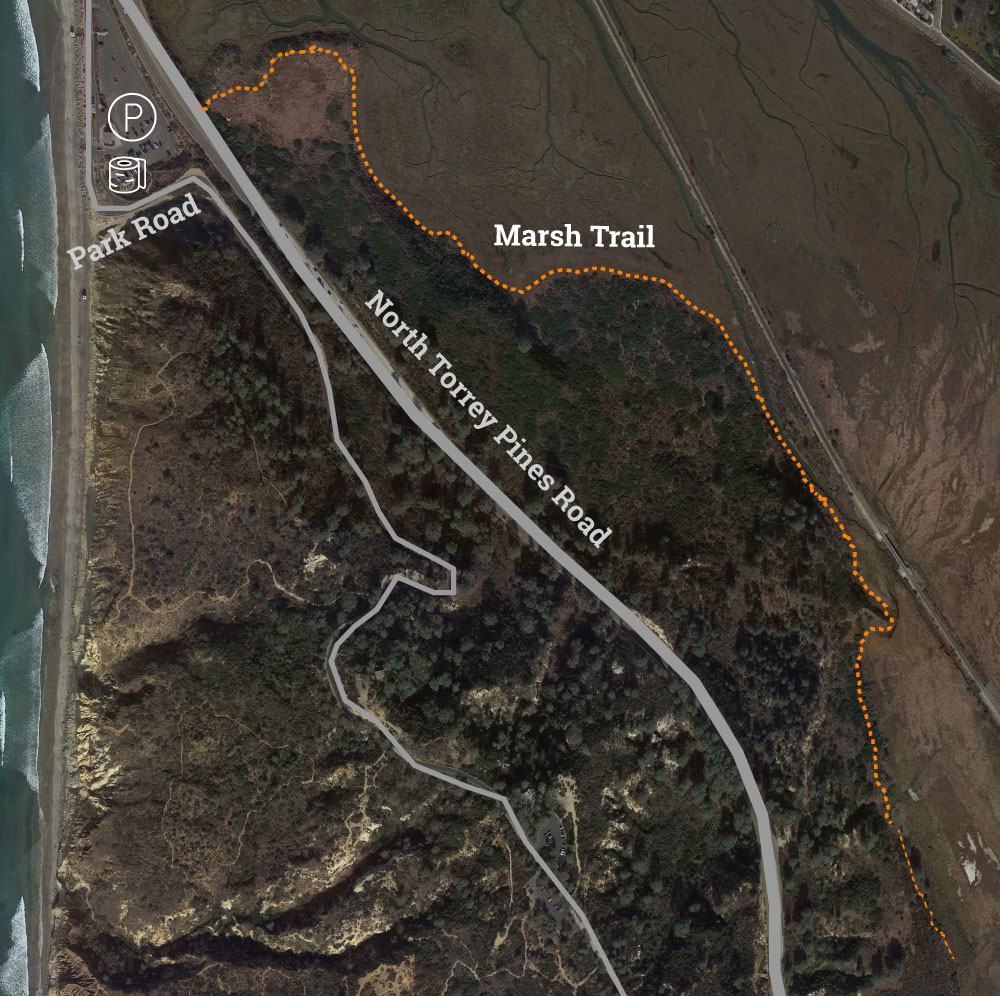
6) Torrey Pines Marsh Trail
Type: Out-and-back
Length: ~4 miles
Difficulty: Easy
Trailhead GPS: 32.927512, -117.258302
Just northeast and inland from the state beach, across North Torrey Pines Road from the ranger booth and lower parking lot, is Los Penasquitos Marsh Natural Reserve. This Torrey Pines hike brings you along the eastern side of the coastal mountains along the edge of the marsh.
North Hiking Trails: Torrey Pines Extension
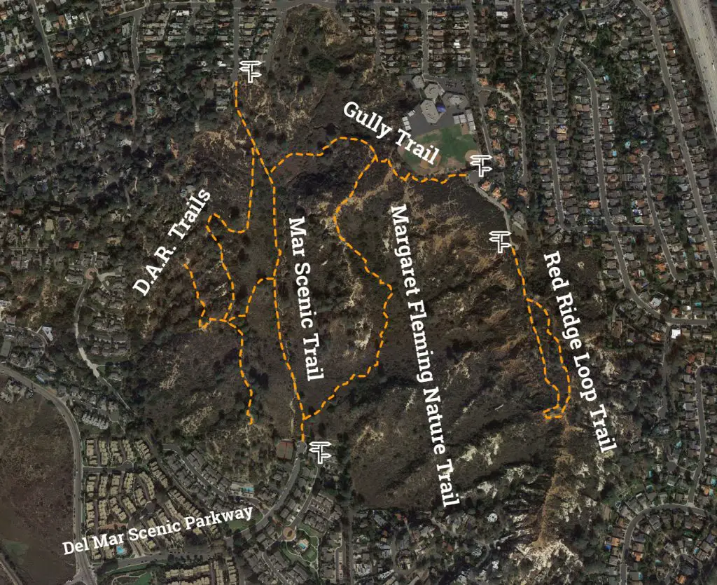
The Northeastern Extension of the reserve is located on the north side of the marsh and lagoon and Carmel Valley Road at the end of Del Mar Scenic Parkway. Surrounded by neighborhoods, this section offers a network of trails.
You can enter the extension trail from several roads, including Del Mar Scenic Parkway via Carmel Valley Road, Mar Scenic Drive, and Mira Montana Drive via Del Mar Heights Road.
The most popular trailhead is the end of Delmar Scenic Parkway at the start of Mar Scenic Trail, which runs north-south through the center of the park extension.
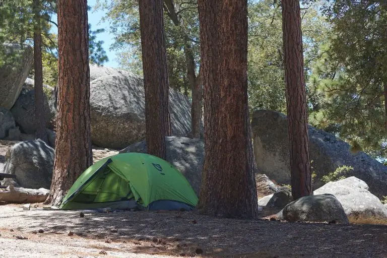
Nearby Camping
If you are looking for a place to camp near Torrey Pines State Reserve, check out San Elijo State Beach Campground and South Carlsbad State Beach Campground.