The Southern California High Country: Six Ranges to Beat the Summer Heat
Summer in Southern California is a lesson in vertical thinking. The coast gets gray and crowded, the valleys bake, and the deserts turn genuinely dangerous from June through September. The high country is the release valve. Drive an hour or two, climb a few thousand feet, and the air gets thinner, drier, and roughly twenty degrees cooler.
SoCal is unusually well-stocked with real mountains. Three ranges anchor the northern half of the region, the San Gabriels, San Bernardinos, and San Jacintos, all reaching above 10,000 feet. San Diego County adds three more: Palomar, Cuyamaca, and the Laguna Mountains, all topping out between 6,000 and 6,500 feet. Smaller, but close enough to San Diego to make a Saturday morning escape workable. Below is a rundown of each range, what it’s good for, and the trails and campgrounds worth knowing before you go.
A note on fire: Southern California’s summer fire season has a habit of closing forests with little warning. Check the USFS closure page for the relevant national forest and the Cal Fire incident map before you commit to a trailhead. Current-year closures can shut down entire ranges.
San Gabriel Mountains
Closest high country to Los Angeles, and the range most Angelenos think of first. The San Gabriels run about 68 miles along the northern edge of the LA Basin, with Mount San Antonio (“Mt. Baldy”) topping out at 10,064 feet. A large portion of the range falls within the San Gabriel Mountains National Monument, which was designated in 2014 and expanded in 2024.
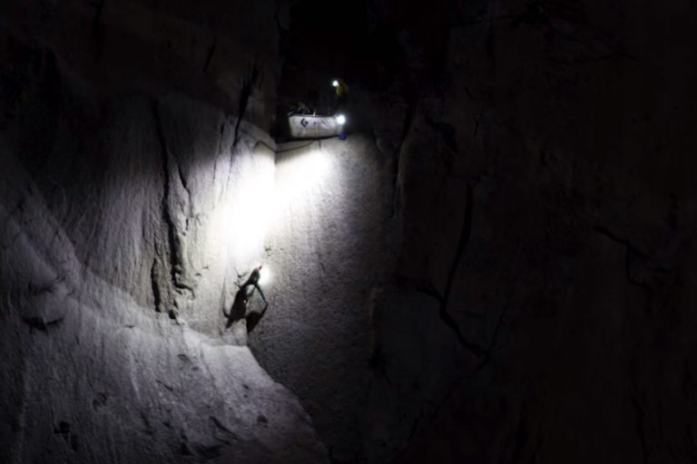
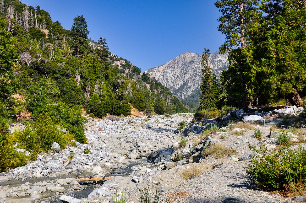
The Angeles Crest Highway (CA-2) is the main artery — it climbs from La Cañada Flintridge to elevations above 7,000 feet, opening up dozens of trailheads that start where most SoCal hikes end. Icehouse Canyon Trail near Mt. Baldy Village is the signature introduction: a 7.2-mile out-and-back through a shaded canyon to Icehouse Saddle at 7,632 feet, and the launchpad for longer objectives like Ontario Peak (12 miles, 8,696-foot summit) and Cucamonga Peak (11 miles, 3,500 feet of gain). For something mellower, Burkhart Trail to Cooper Canyon Falls starts at 6,440 feet in old-growth pines, and Switzer Falls is a 5-mile hike to two cascades.
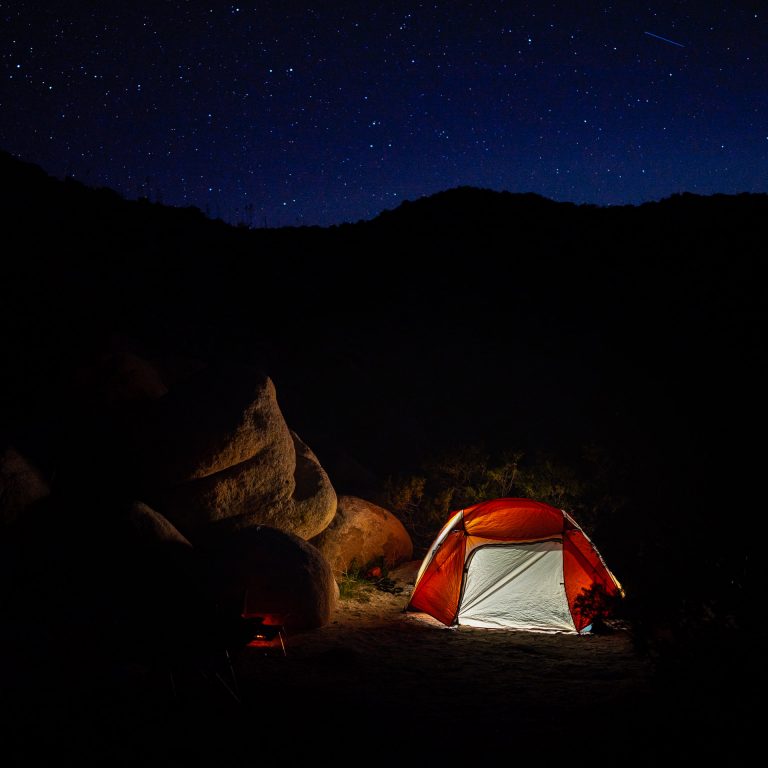
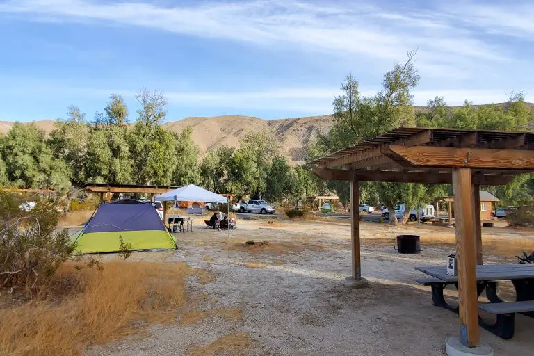
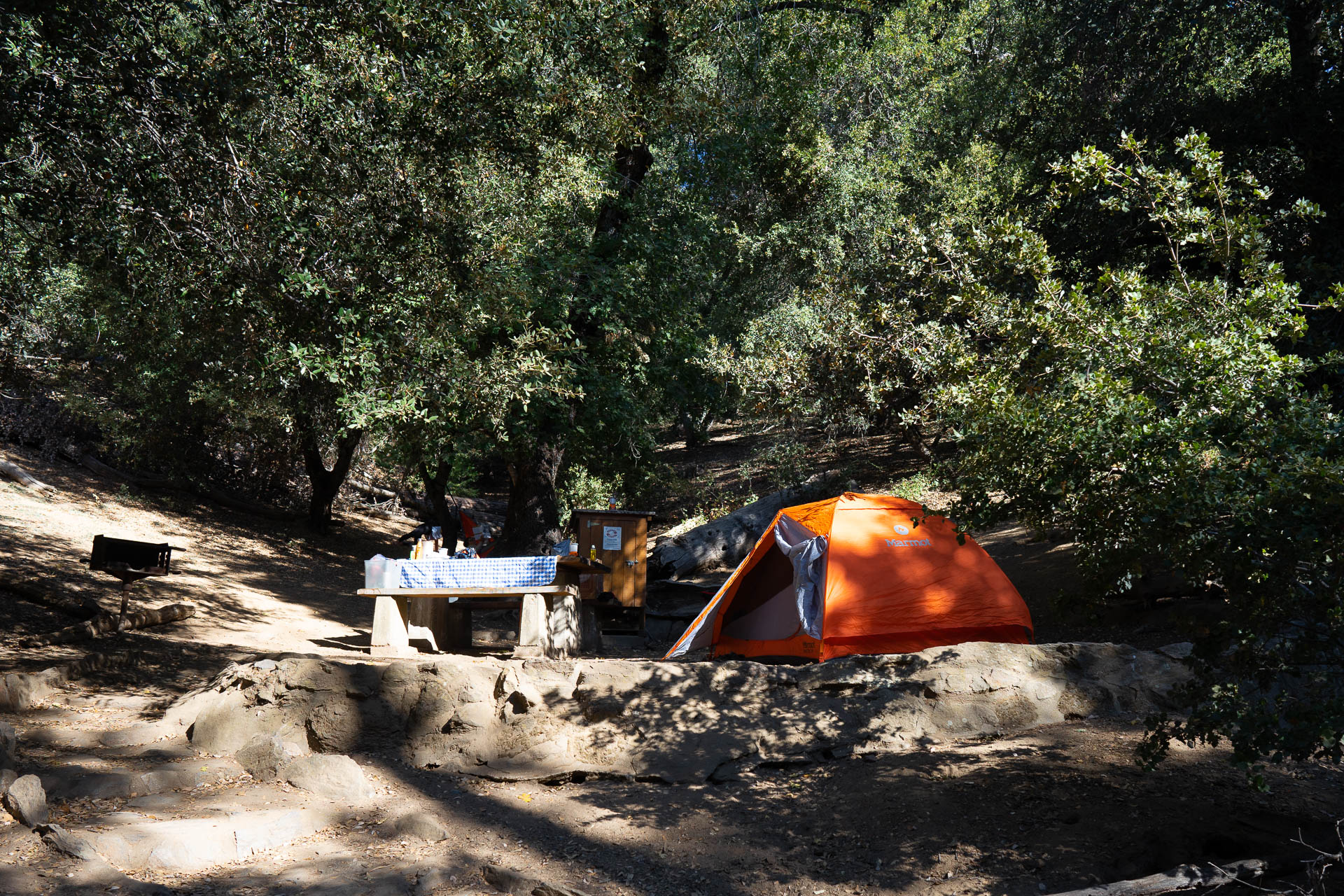
For camping, Crystal Lake Campground sits at 5,539 feet on Highway 39 — first-come-first-served, 120 sites, and explicitly pitched as a break from lower-elevation heat. Chilao Campground off Angeles Crest is another solid first-come option and provides direct access to the Silver Moccasin Trail. Fire history note: the range is still recovering from the 2020 Bobcat Fire. Some trails and access roads remain affected, so verify conditions before you go.
San Bernardino Mountains
The highest ground in Southern California. San Gorgonio Mountain reaches 11,499 feet — the tallest peak anywhere in California south of the Sierra — and the San Gorgonio Wilderness around it offers 81 miles of trails through terrain that genuinely feels sub-alpine. To the north, the range widens around Big Bear Lake (6,750 feet) and Lake Arrowhead (5,114 feet), which between them anchor most of the recreation infrastructure.
Big Bear is the hub. The Big Bear Lake Hiking Guide covers the trail network in depth, but the two worth singling out are Sugarloaf National Recreation Trail — a 10-mile out-and-back to 9,952 feet, the highest point in Big Bear Valley — and Cougar Crest for a more moderate 4.6-mile option with lake views. Castle Rock is the short, steep classic: a mile each way with 500 feet of gain and a summit boulder pile that earns the name.
For the suffer-fest entry, the San Gorgonio Wilderness is the place. Momyer Creek Trail is a 13-mile out-and-back with a creek crossing and 3,123 feet of gain, and the Vivian Creek route to the San Gorgonio summit is 19 miles with 5,492 feet of climbing — generally done as an overnight. Wilderness permits are required; get them from the Forest Service ahead of time.
Camping anchors: Pineknot Campground at 6,900 feet is the classic Big Bear base (47 reservable sites among pines and firs), and North Shore Campground puts you three miles from Lake Arrowhead Village in mixed oak and conifer forest.
San Jacinto Mountains

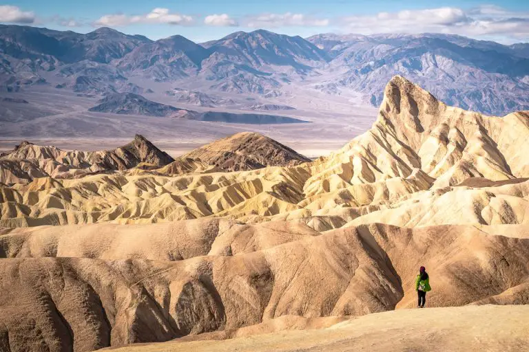
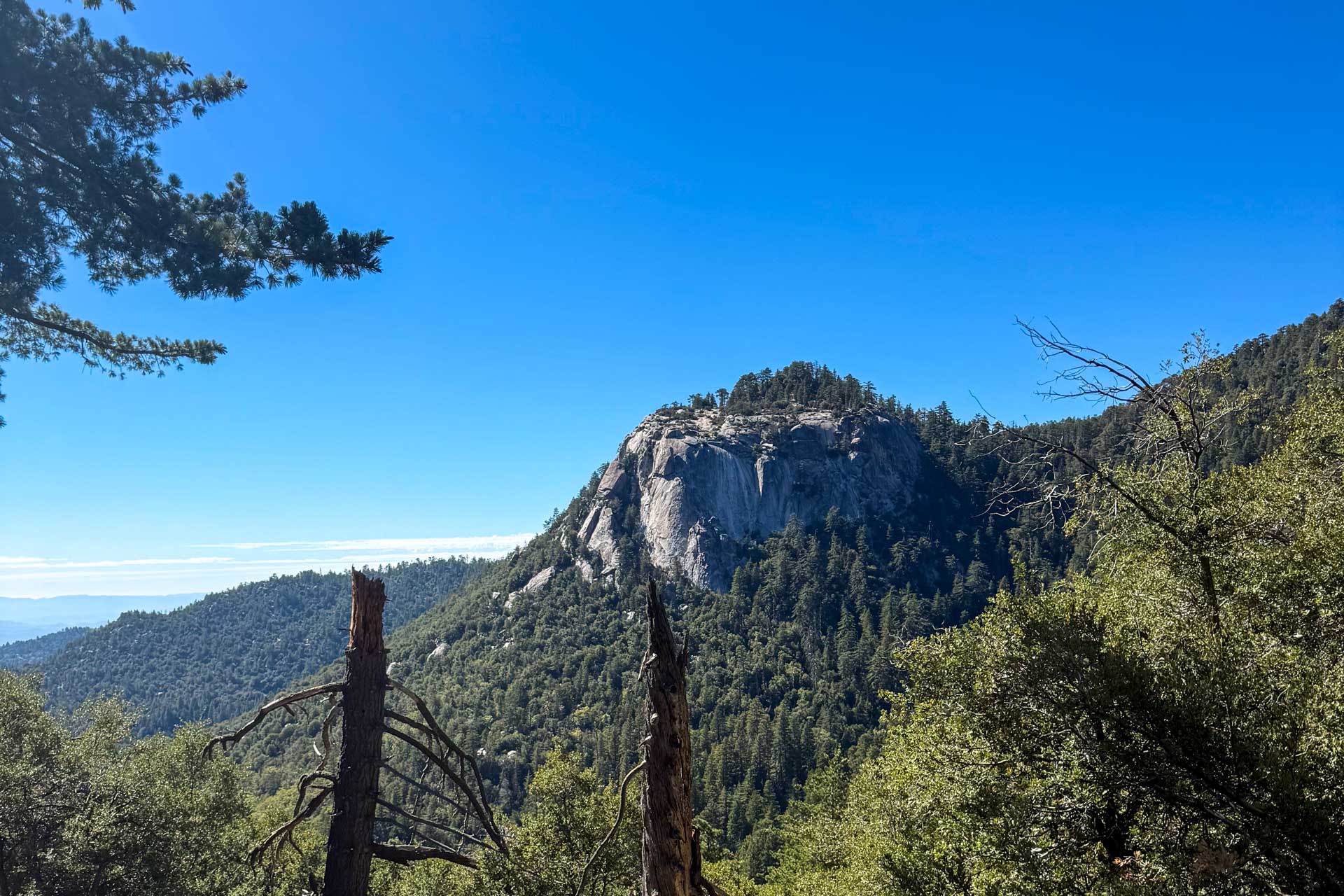
The San Jacintos are the most dramatic of the three northern ranges — a nearly sheer 10,000-foot rise from the floor of the Coachella Valley that’s as striking as any relief in the Lower 48. San Jacinto Peak tops out at 10,834 feet. The Santa Rosa and San Jacinto Mountains National Monument covers the southern and eastern flanks, spanning sun-scorched desert canyons to snow-patched summits.
Two access points matter. Idyllwild, on the western side, is the traditional mountain town — alpine, pine-shaded, and cool most of the summer. Devils Slide Trail is the signature day hike there: 2.5 miles into the San Jacinto Wilderness, with connections to Tahquitz Peak, Lily Rock, and the PCT. Ernie Maxwell Scenic Trail is the easy counterweight — 2.6 miles, shaded, and a good choice if you’re traveling with family.
The other way up is the Palm Springs Aerial Tramway, which climbs from the desert floor to Mountain Station at 8,516 feet in about ten minutes. From there, Desert View Trail is a short loop that gets you into subalpine country without any approach drive. On a 108-degree day in Palm Springs, it’s 75 at the top. Hard to oversell that.
For camping, Dark Canyon Campground sits in a forested stretch of the San Bernardino National Forest about eight miles north of Idyllwild, and Marion Mountain Campground is the Forest Service option closest to town.
Palomar Mountain
San Diego County’s northernmost high country and the first real alpine escape if you’re coming from the coast. Palomar tops out at 6,138 feet on High Point, with the state park and forest service land clustered around the 5,000-foot band — tall enough that the ecosystem (dense evergreen, fern understory, running creeks) looks nothing like the chaparral you drove through to get there. The area is split between Palomar Mountain State Park and portions of Cleveland National Forest.
The Palomar Mountain Camping Guide is the single best jumping-off point — it covers Doane Valley (state park, 4,730 feet, streamside), Fry Creek (forest service, 4,900 feet, dense shade), Observatory Campground (across from Palomar Observatory), and the group campgrounds at Cedar Grove and Crestline. Doane and Fry both book up; reserve ahead during summer.
Day hiking is modest but worthwhile. Boucher Hill Loop is a 3-mile oak-woodland climb to a historic fire tower that’s sometimes open to visitors when staffed. The Observatory Trail from Observatory Campground climbs up to near the 200-inch Hale Telescope — worth the walk up even if the observatory itself isn’t on the tour schedule.
For off-roaders and overlanders, Nate Harrison Grade is a 9.5-mile dirt truck trail that climbs 4,600 feet from Pauma Valley to the top of the mountain — a better approach than the paved road on a weekday and a legitimate way to arrive at camp. If you’re looking for something between camping and a hotel, Bailey’s Palomar Resort offers historic cabins, yurts, and glamping tents on a homesteaded property dating to 1888.
Cuyamaca Mountains
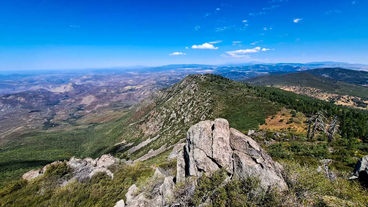
An hour east of San Diego on I-8, the Cuyamacas are the most accessible high country for most San Diegans. Cuyamaca Peak is the second-highest mountain in San Diego County at 6,512 feet, and on a clear day the summit view takes in the Pacific, the Channel Islands, the Colorado Desert, the Salton Sea, and Mexico. Most of the range sits inside Cuyamaca Rancho State Park — 24,677 acres of oak woodland, pine stands, and grassy meadows, with more than half of it classified as wilderness. It’s fundamentally different country from the chaparral that surrounds it.
The two signature day hikes are Cuyamaca Peak and Stonewall Peak. Cuyamaca Peak is a 6-to-8-mile effort depending on your trailhead (starting from Paso Picacho via Lookout Road is the most direct); Stonewall is a 4-mile out-and-back to a granite outcrop with 360-degree views, starting right across Highway 79 from Paso Picacho Campground. Both are exposed and can bake in mid-afternoon — get early starts, especially in July and August.
The Cuyamaca Rancho Camping Guide is the full overview. Paso Picacho is the 85-site family campground near the heart of the park, with four rustic cabins, and it’s the best base if you’re doing Stonewall or Cuyamaca Peak. Green Valley Campground is the southern option (81 sites at 4,000 feet along the Sweetwater River). Fire history matters here too — the 2003 Cedar Fire burned through much of the park, and recovery is visible. Some of the new-growth forest is striking in its own right.
Laguna Mountains
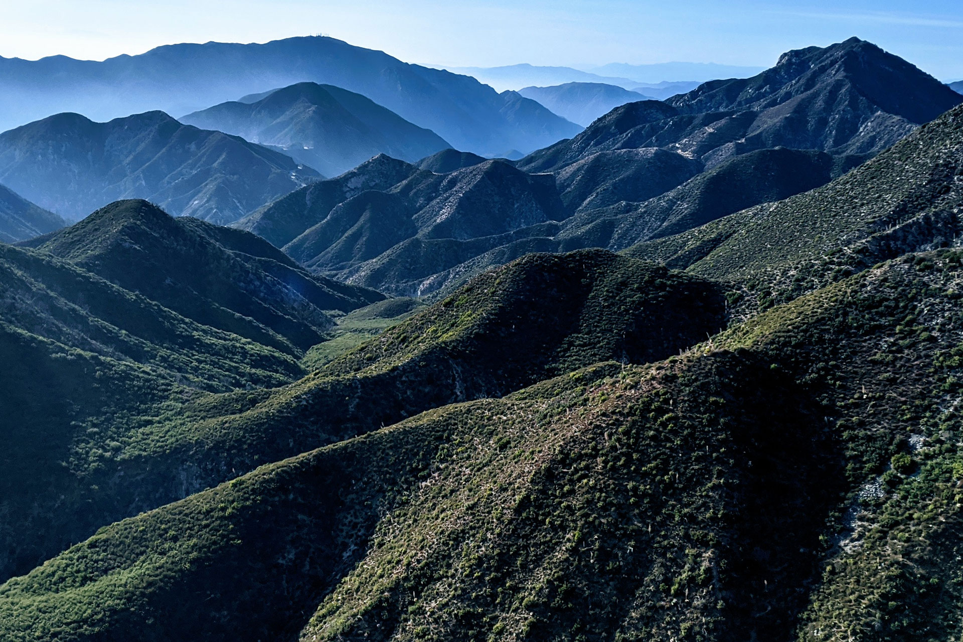
Furthest south and furthest east of the San Diego ranges, the Lagunas stretch about 35 miles northwest from the Mexican border along the eastern edge of Cleveland National Forest. The Mount Laguna village sits at 6,000 feet and anchors the recreation area, with meadows and pine forest that genuinely don’t feel like Southern California. The PCT passes through, and the eastern edge of the range drops abruptly into Anza-Borrego.
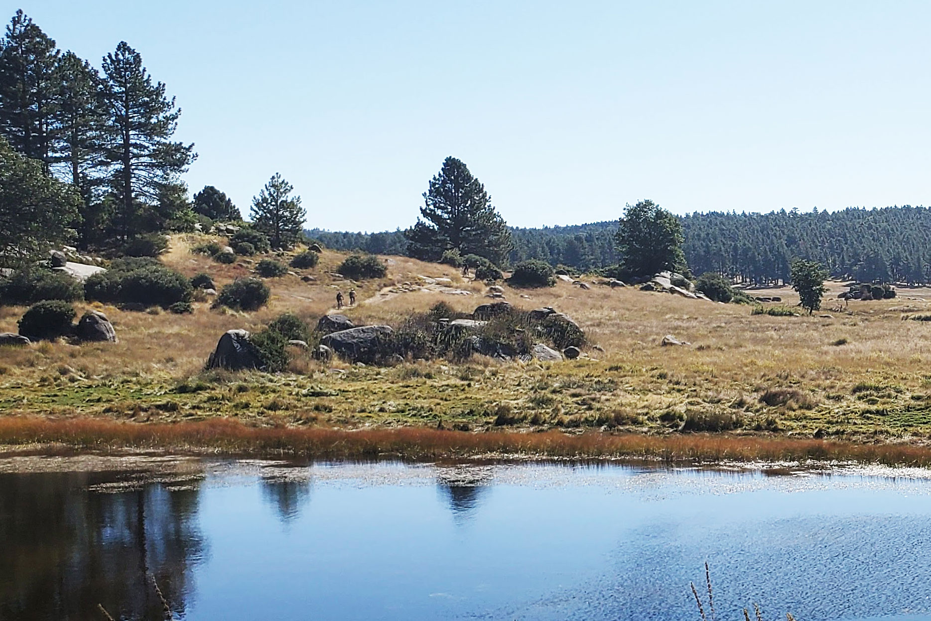
This is arguably the best summer range in San Diego County for a mix of hiking, mountain biking, and equestrian use. The Laguna Meadow Trail Network out of Laguna Campground is the centerpiece — connected, well-signed, and rideable. The PCT section across Sunrise Highway from the campground offers overlooks into Anza-Borrego that are hard to beat, especially Storm Canyon Overlook less than a mile north of the campground and Kwaaymi Point four miles north.
For camping, the Mount Laguna Camping Guide covers the full set of options. Laguna Campground has 104 sites, flush toilets, and coin-op showers — the most developed option on the mountain. El Prado Group Campground next door at 5,600 feet is the place if you’re organizing anything group-scale, with five well-spaced group sites accommodating 30 to 50 people each. Summer campfires may be prohibited during high fire danger; check the Cleveland National Forest page before you go.
Practical Notes
A few things worth knowing across all six ranges:
Reservations. Most developed campgrounds — particularly at Big Bear, Palomar, and Cuyamaca — fill up on summer weekends months in advance. Book through Recreation.gov (forest service) or ReserveCalifornia.com (state parks). First-come options at Crystal Lake, Chilao, and Fry Creek are worth knowing as backups.
Passes. An Adventure Pass is required to park at most Forest Service trailheads in the San Gabriels, San Bernardinos, and San Jacintos. State park trailheads at Cuyamaca and Palomar charge a day-use fee. Interagency Annual Passes cover the Forest Service fee if you have one.
Fire and closures. Summer is fire season. Forest closures, trail closures, and campfire restrictions change week to week. Check the relevant national forest site and Cal Fire before committing to a plan.
Water. Seasonal creeks in the San Gabriels, San Gorgonio, and Palomar can be low or dry by mid-summer. Don’t rely on trail-reported sources without a recent trip report. Carry more than you think you need.
Temperature. The rough rule is three to five degrees cooler per 1,000 feet of elevation gain. A 105-degree afternoon in the Coachella Valley is mid-70s at Mountain Station on the Palm Springs Tram. It’s a real difference, and the whole reason these ranges exist as a summer play.