Chandler Bikeway Trail Guide
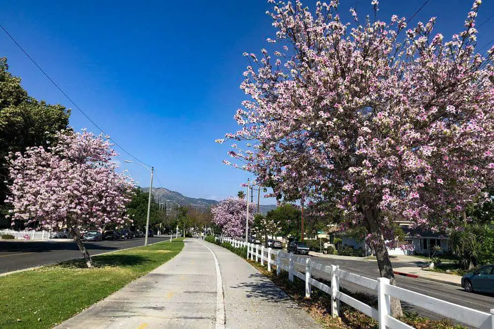
Chandler Bikeway Trail is an easy suburban trail located in Burbank, California. Given its name, this trail is obviously extremely popular with bike riders but that is not say it is not often frequented by lone-walkers, hikers, couples, families and dog walkers.
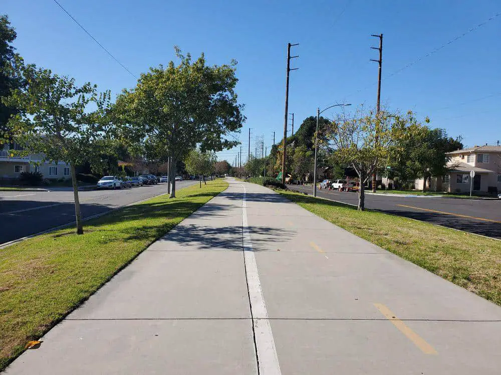
The trail offers beautiful views of the Burbank area and is easy to navigate, running in the median between lanes of traffic on Chandler Boulevard. It is perhaps the most popular of several bikeway trails in the area and is often rather busy and can be enjoyed year-round.
Trail Details
| Trail Type | Combination or loop |
| Difficulty | Easy |
| Length | ~5.6 miles round-trip |
| Elevation Gain/Loss | 15 feet/-15 feet |
| Burbank Trailhead Coordinates | 34.17945, -118.32433 |
| North Hollywood Trailhead Coordinates | 34.16859, -118.37015 |
| Location | Burbank, California |
| Best Season | Year-round, fall recommended |
Getting to Chandler Bikeway Trail
It should be noted that there are two different ‘trail end points’ on this route: the intersections of N. Mariposa Street and West Chandler Blvd (Burbank) and Fair Ave and West Chandler Blvd (North Hollywood). That should be considered before you start your route so plan accordingly.
The information in this guide is for informational purposes only. We use Gaia GPS for mobile devices and also bring high-quality printed topographic maps while in the backcountry, and recommend you do the same.
As always, GPS technology is the easiest way to ensure you reach the trailhead without issue, but for those who prefer manual instructions, consider that we start from Interstate 5 on our journey. To reach the eastern trailhead from I-5, take the West Burbank Boulevard exit and take a left onto West Burbank Boulevard.
Then, after around 0.3 miles, you should take a left onto Victory Boulevard. Keep going for around a quarter-mile and you will take a right onto West Chandler Boulevard. Another quarter mile up reaches the trailhead.
In order to reach the western trailhead from I-5, you should take the West Burbank Boulevard exit and take a left onto West Burbank Boulevard. After 3.2 miles, take a left onto Vineland Avenue. The trailhead is then, once again, a quarter-mile away on the left at the intersection with Chandler Boulevard. Parking details for both trailheads are outlined below.
Parking at Chandler Bikeway Trail
The location of this trail is relatively urban compared to what you would consider a traditional trail route. Located in the neighborhood of Burbank, California. Given its location on Chandler Boulevard, there is an abundance of street parking available to take advantage of.
There is usually enough street parking for all and is available on both starting points. For the northern trailhead, parking is on street to the left of the starting point. For the eastern trailhead parking is again on street and around a quarter-mile up Chandler Boulevard.
Please pay attention to all signage or any notices in order to avoid any parking issues or tickets.
The Trail
Chandler Bikeway Trail is a trail which is based at the top of the Southern Pacific’s old Burbank Branch in Burbank, California. The trail is around 5.6 miles round-trip, or 9km and would take around one and a half hours to complete for the average hiker.

Given its name, the trail is naturally associated with bike-riding but this is also popular trail for those seeking to birdwatch, normal hikers, and simply those seeking some solitude on a lone walk, family outing or to take the dog for an adventure.
It is also not uncommon to see people skating, skateboarding, running or scooting on this versatile trail that has only grown in popularity with both local residents and tourists in recent years.
The trail is usually busy during the morning and early afternoon but can be peaceful later on for those seeking some quiet time. The trail is open year-round and stunning views can be enjoyed at any time, although if a lover of trees the fall makes for a particularly spectacular scene to enjoy the abundant trees which line the route.

There is also little shade at some times of the year so you should also bear that in mind when deciding to go to Chandler Bikeway Trail. As per above, dogs are welcome, but must be on a leash at all time for their own safety and that of other walkers/bike riders.
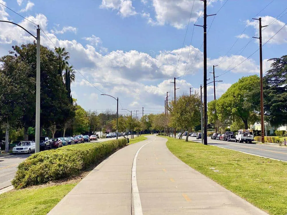
Prior to coming to Chandler Bikeway Trail, one could be forgiven for thinking that this trail is merely for those riding bikes, but that is certainly not the case. The trail is a safe haven for bike riders who wish to enjoy a scenic route as the bike lines are clearly marked for bike riders and they get to enjoy a safe, pleasant ride alongside other members of the public who may be on foot, skating, dog-walking or taking a run. Pedestrian lanes are also clearly marked.
This is a surprisingly beautiful trail and trees are plentiful as well as public works of art which line the way, making for a truly relaxing and enjoyable scenery. During the final part of the trail (the last mile or so), you are treated to public art that is truly stunning, including murals on the side of buildings that were specially commissioned by council and local artists.
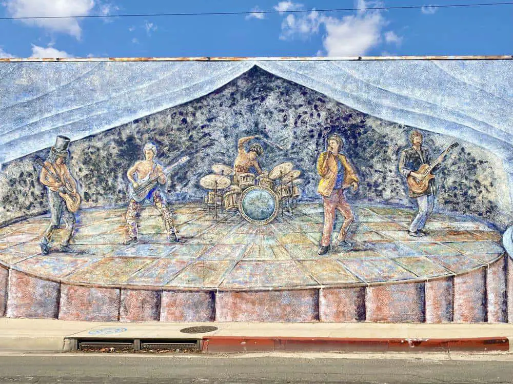

Other artwork includes musical tributes and specific California natural beauty spots which are brought to life. This is something I wasn’t expecting to see and made for a really enjoyable treat.
For the first two miles or so of the trail, the path runs alongside the delightful Burbank neighborhood that it passes through – with many stunning homes in the area. True to the SoCal surroundings, the homes are adorned with beautiful gardens and colorful trees that only add to the truly wonderful and unique views that can be enjoyed throughout this trail.
The true beauty of this trail lies in its simplicity, nestled within the neighborhood of Burbank and a real retreat from the surrounding areas and the bustling city of Los Angeles. The trail was converted from railroad tracks that ran through Burbank and has been modified and extended throughout the years, the most recent of which were 2013 works to improve the trail, plant more trees and make it more accessible for all, not just bike riders, with designated lanes.
For lovers of wildlife, this trail probably isn’t going to be a favorite of yours. Throughout the trail, however, be sure to keep your out in the skies above for the varied birdlife that often frequent the trees. The Los Angeles River is nearby to the end of the trail, too, so there is that option should you wish to seek out more wildlife than typically available on Chandler Bikeway.
For those seeking adventure beyond this specific trail, the bikeway connects to a myriad of bike paths throughout the metropolitan area, including the Los Angeles River Trail and these are easily accessible by simply following the trail to another, ensuring the fun continues.
There is a wonderful community feel about this trail, despite being extremely popular with tourists also, and it is something of a hidden gem tucked away in Burbank, but is now growing in popularity rather rapidly. Although there are connecting bikeways as outlined above, the trail itself ends at Fair Avenue just a short distance away from North Hollywood.
Another great feature of this trail is that you can take public transport to and from it quite easily as there exists metro stations just a short walk from both the trailheads and the endpoint at Fair Avenue, which serves North Hollywood and greater Los Angeles areas.

