Momyer Creek Trail

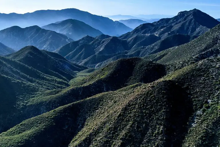
Momyer Creek Trail is a difficult 18.4-mile out-and-back route in the San Gorgonio Wilderness of Southern California that offers solitude and sweeping views of Mill Creek Canyon and the Yucaipa Ridge. Starting at 5,400 feet near the community of Forest Falls, this trail steadily climbs to nearly 10,000 feet at Dollar Lake Saddle.
Hikers will pass through diverse forest landscapes, several remote campsites, and a creek crossing that can be hazardous at high water. Its remote feel and steep climbs make it ideal for experienced hikers seeking a quieter alternative to more popular routes in the area. The trail is named for Joe Momyer, who advocated for the protection of this wilderness in the 1960s.
Trail Details
| Trail Type | Out-and-back |
| Difficulty | Difficult |
| Length | 18.4 miles (round trip) |
| Time | 10-12 hours or overnight |
| Elevation Gain/Loss | +4,600 ft / -4,600 ft (approx.) |
| Trailhead Coordinates | 34.087048, -116.914872 |
| Location | San Gorgonio Wilderness, CA |
| Season | Late spring to early fall (TBD) |
| Information Number | TBD |
Getting to Momyer Creek Trailhead
From Redlands or the greater Inland Empire, take Highway 38 east toward Forest Falls. About 15 miles after you leave the Redlands area, look for the turnoff to Forest Falls and head east along Valley of the Falls Drive. Continue for roughly three miles until you see a large parking area on the left, located about 100 yards before the local fire station. This is the main lot for the Momyer Creek Trailhead; there are no restrooms here, but facilities can be found up the road at Big Falls Picnic Area.
If you’re traveling from the Los Angeles area, take Interstate 10 east toward Redlands and connect with Highway 38 east. Proceed as described above to Forest Falls, keeping an eye out for signs to the community and Valley of the Falls Drive. The trailhead parking area is the same large lot just before the fire station.
The Trail

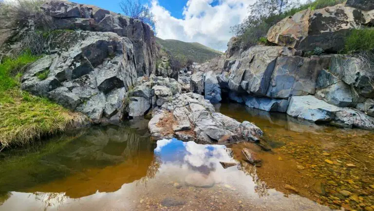
From the parking area (5,400 feet), the trail descends a short distance to Mill Creek Wash. Exercise caution when crossing the creek—there is no bridge, and high water can make the crossing unsafe. In dry or moderate conditions, the crossing is manageable by hopping stones or wading carefully.
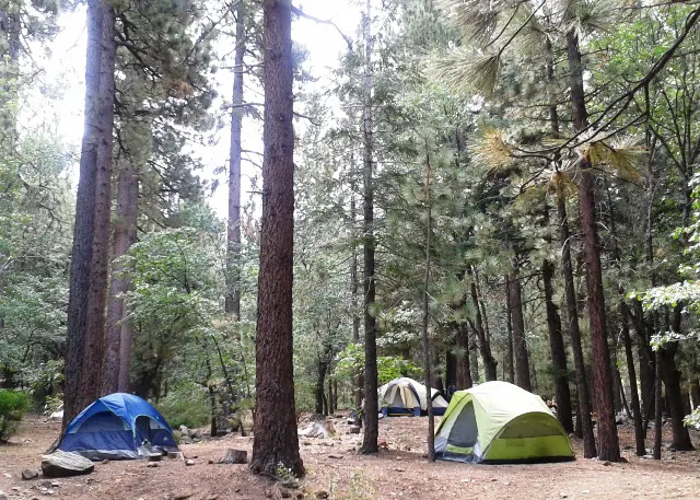
After the crossing, the path climbs gently through mixed conifer forest. You’ll notice fewer hikers here than on neighboring routes, lending a sense of solitude. At 3.7 miles from the wash is Alger Creek Camp (7,100 feet). The trail to the camp veers about a quarter mile downhill from the main path, and there is a single campsite. Continue another two miles to reach Dobbs Camp (7,200 feet), which typically has water available in the creek.
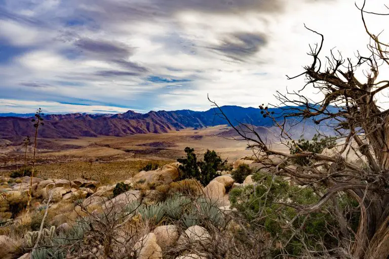
Beyond Dobbs, the trail begins a steadier climb. After 1.5 miles, you’ll reach Saxton Camp (8,400 feet). A small spring 0.2 mile below the camp provides water, though flows can be low in late summer. Throughout these middle stretches, the terrain transitions from mixed forest to taller stands of pine and occasional open vistas of Mill Creek Canyon.
The final two miles to Dollar Lake Saddle ascend through higher-elevation forest, with the trail topping out at about 9,960 feet. From this saddle, you can take in impressive views of the surrounding San Bernardino mountains and continue on connecting routes if you wish. Hikers often turn around here for the return trip. Keep in mind that altitude, weather, and fatigue can affect your pace, so plan accordingly.
Throughout the hike, be prepared for variable weather. The high elevations can hold snow in spring and early summer, and afternoon thunderstorms can develop in warmer months. Bring sufficient water and a filter or purification system if you plan to use creek sources. Because this wilderness area is less traveled, carry navigation tools such as a map, compass, or GPS device, and practice Leave No Trace principles to keep the trail pristine.
Camping
There are several rustic camping options along Momyer Creek Trail. Alger Creek Camp, roughly 3.7 miles in, is the first site you’ll encounter. Dobbs Camp follows two miles farther and offers a reliable water source. After another 1.5 miles, you’ll find Saxton Camp, which has a small spring nearby. Each site is relatively secluded and suitable for overnight stays if you plan to break up the hike or simply enjoy the remoteness of the wilderness. Always check with the local ranger station regarding permits, fire restrictions, and water availability before setting out.