Willow Canyon Trail – Death Valley

Willow Canyon Trail is a moderate 4.2-mile out-and-back hike located in Death Valley National Park, California. This moderate to difficult trail offers hikers the chance to navigate unmarked gravel roads and discover a seasonal waterfall nestled within a deep canyon. Situated approximately 31.5 miles south of CA-190 on Badwater Road, the trail presents a rewarding experience for cross-country navigators seeking solitude and natural beauty in one of California’s most iconic landscapes.
Trail Details
| Trail Type | Out-and-Back |
| Difficulty | Moderate |
| Length | 4.2 miles (6.8 km) round trip |
| Time | 2.5 hours round trip |
| Elevation Gain and Loss | 776 ft (237 m) gain |
| Trailhead Coordinates | 36.0656141, -116.7448888 |
| Location | Badwater Road, Death Valley National Park |
| Season | October – May (Summer months are very hot) |
| Information Number | 760-786-3200 |
How to Get to the Willow Canyon Trailhead
To reach the Willow Canyon Trailhead, start from the town of Furnace Creek in Death Valley National Park. Head south on Badwater Road (CA-190) for approximately 31.5 miles, between mile markers 31 and 32.
Look for an unmarked gravel access road on the right; this road is less than half a mile long and is typically passable by sedans. The parking area is a large, open gravel space capable of accommodating buses and RVs. There are no nearby restrooms.
Trail Overview
Willow Canyon Trail begins at a gravel parking area along Badwater Road. From the parking lot, hikers follow an unmarked gravel access road that extends less than half a mile. Once on the main trail, avoid the small foothills and canyons to the east. Instead, proceed north-northeast, wrapping around the foothills to approach the deep canyon nestled within the surrounding mountains.
The terrain is primarily composed of a rocky alluvial fan, presenting a challenging surface that demands careful footing. The exposed nature of this section means hikers will be under full sun for most of the journey, necessitating adequate water and sun protection.
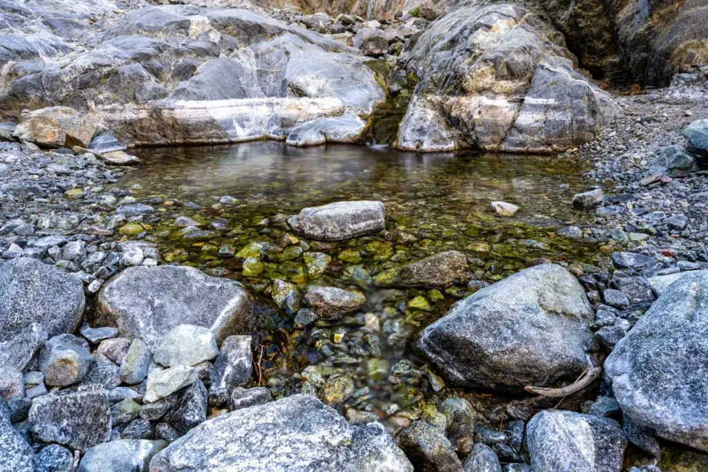
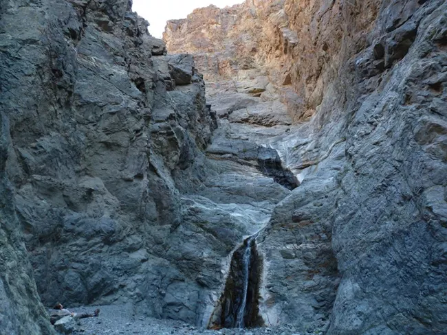
As you advance, the trail becomes more rugged and transitions to polished bedrock within the final quarter mile. This last stretch leads into a narrow canyon where the seasonal waterfall awaits. The waterfall serves as a natural reward for those who successfully navigate the trail’s less defined sections, offering a picturesque endpoint to the hike.
Throughout the hike, the landscape showcases Death Valley’s characteristic arid environment, with sparse vegetation adapted to the harsh conditions. Wildlife sightings are possible but not guaranteed, as the remote location tends to limit frequent animal activity. Hikers should remain vigilant for rattlesnakes and other desert-adapted species.
Key landmarks include the transition from the alluvial fan to the polished bedrock, marking the approach to the canyon. The trail’s difficulty varies, with the initial gravel road being relatively straightforward, while the latter sections require more effort and attention. The elevation gain of 776 feet is primarily concentrated in the middle portion of the hike, contributing to the overall challenge.
Given the trail’s remote nature and minimal amenities, hikers should prepare thoroughly, carrying sufficient water, food, and emergency supplies.
Camping
Camping options near Willow Canyon Trail are limited due to the trail’s remote location within Death Valley National Park. The nearest established campgrounds are located in Furnace Creek and Stovepipe Wells, both offering amenities such as water, restrooms, and designated camping areas.
For those seeking a more secluded experience, dispersed camping is permitted in certain areas of the park. Check out our guide to camping in Death Valley for more details.