Oak Canyon Trail Guide
Oak Canyon Trail in San Diego’s Mission Trails Regional Park is one of the most diverse hikes in the park, offering a satisfying mix of historical landmarks and natural beauty.
This moderate 3.2-mile trail brings you past the Old Mission Dam, built by Spanish missionaries over 200 years ago and along a verdant river valley.
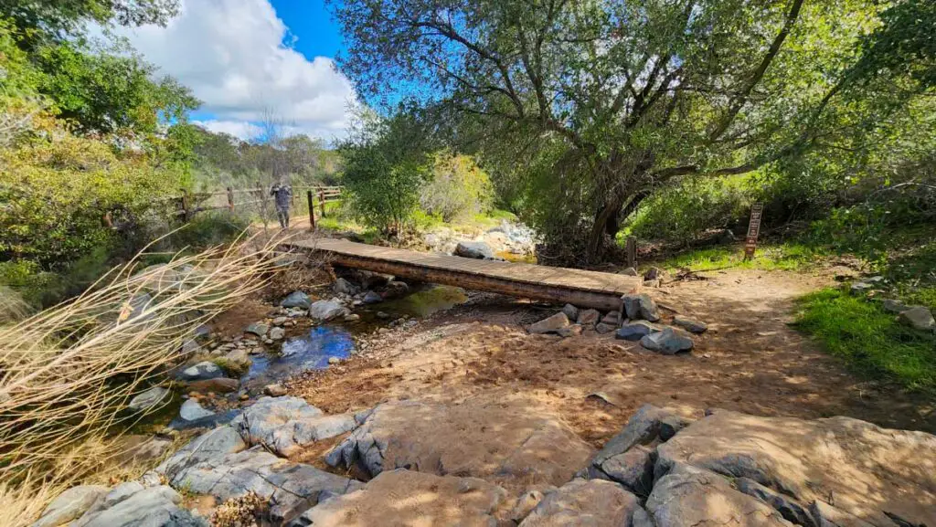
The trail passes under giant oak trees and crisscrosses the creek along wooden bridges. During the wet season, the trail passes by two running waterfalls that feed into striking rock gorges.
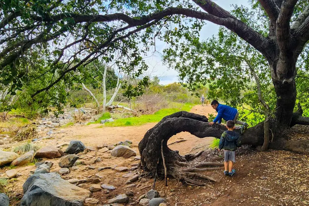
It’s a great family hike, with a few rocky sections that will challenge the kiddos–but not too much. It is important to keep an eye on kids when you get close to the waterfalls, as there are some 10-15 cliffs in these areas.
Getting to Oak Canyon Trail
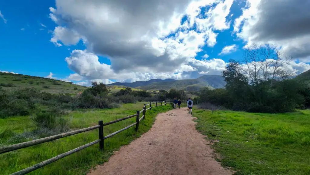
To get to the trailhead from Highway 52, take the Mast Boulevard exit near Santee and head east. Go 0.2 miles (it comes up fast) and turn right on West Hills Parkway. After 0.7 miles, turn right onto Mission Gorge Road, then go 2.4 miles and turn right on Father Junipero Serra Trail. Go 1.7 miles and park at the lot near Old Mission Dam on the right. The trail starts at the north end of the parking lot.
The Trail
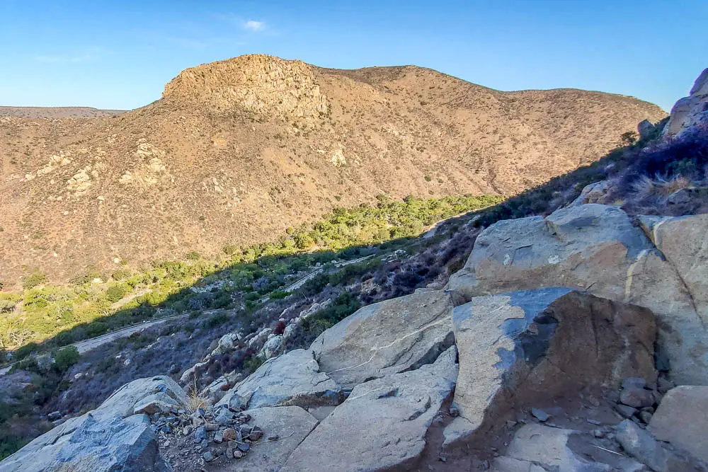
Oak Canyon Trail is a terrific hike on its own and is also a segment of Fortuna Mountain Trail, a loop that brings you over both the north and south summits of Fortuna Mountain. Here will cover the Oak Canyon section only.
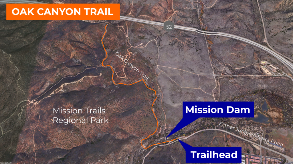
The trail starts at the Mission Dam parking lot and heads southwest deeper into the gorge, following the San Diego River and paralleling Father Junipero Serra Trail road and bike path. In about 200 feet, you pass by the dam on the right, which is worth a look.
A nationally registered historic landmark, the dam was built in 1803 by Spanish Catholic missionaries and Native Americans to store water for irrigation for the fields of the Mission San Diego de Alcalá.
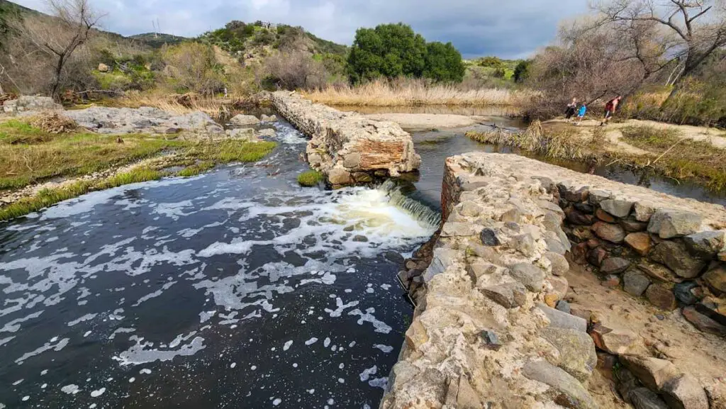
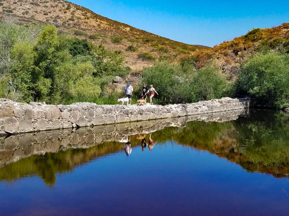
The mission, first established in 1769 by Spanish friar Junípero Serra, was the first Spanish mission in what is now The State of California. The dam, made of cobblestones, bricks, and cement, fed water into a tile-lined aqueduct that carried water five miles to the mission.
The dam is now an idyllic setting with birds flitting around and splashing in the slow-moving reed-rimmed pool and water trickling through breaks in the crumbling structure.
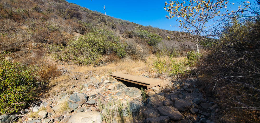
From the dam, the path continues west for 600 feet to a large metal bridge that crosses the San Diego River. This will become a theme of the hike, as smaller wooden bridges cross the creek in Oak Canyon several times.
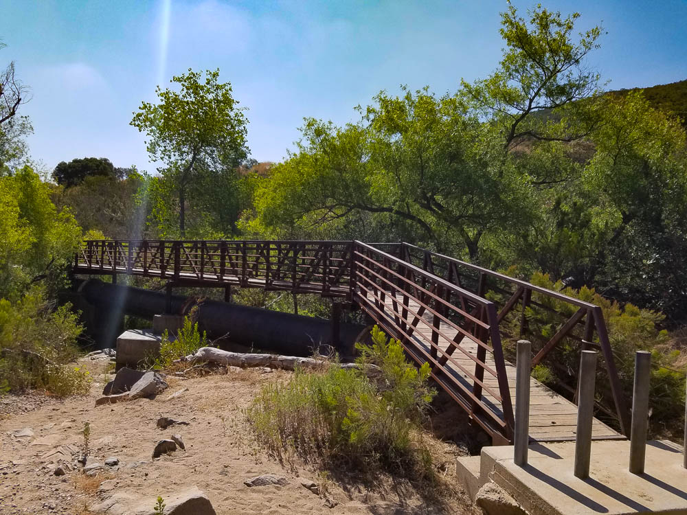
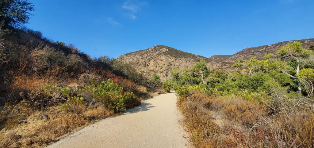
After the bridge, the trail makes a horseshoe bend through a rocky and sandy area before beginning to climb into Oak Creek Canyon through stands of large oak and sycamore trees.
After climbing this first slope and traveling about 1000 feet past the initial large bridge crossing, you’ll come to an intersection where several paths come together. Head left (north) to follow the trail along Oak Canyon Creek.
The trees in this section are impressive as the trail passes under expansive oaks that provide a surprising amount of shade in this chaparral ecosystem. After another fifth of a mile or so the trail will fork, with the left path continuing along Oak Canyon creek and the right pass bringing hikers and mountain bikers to the Grasslands Trail.
Following the left fork, you’ll come to a giant oak tree in about 250 feet. The branches of this tree form a verdant cave that’s a quick break to explore.
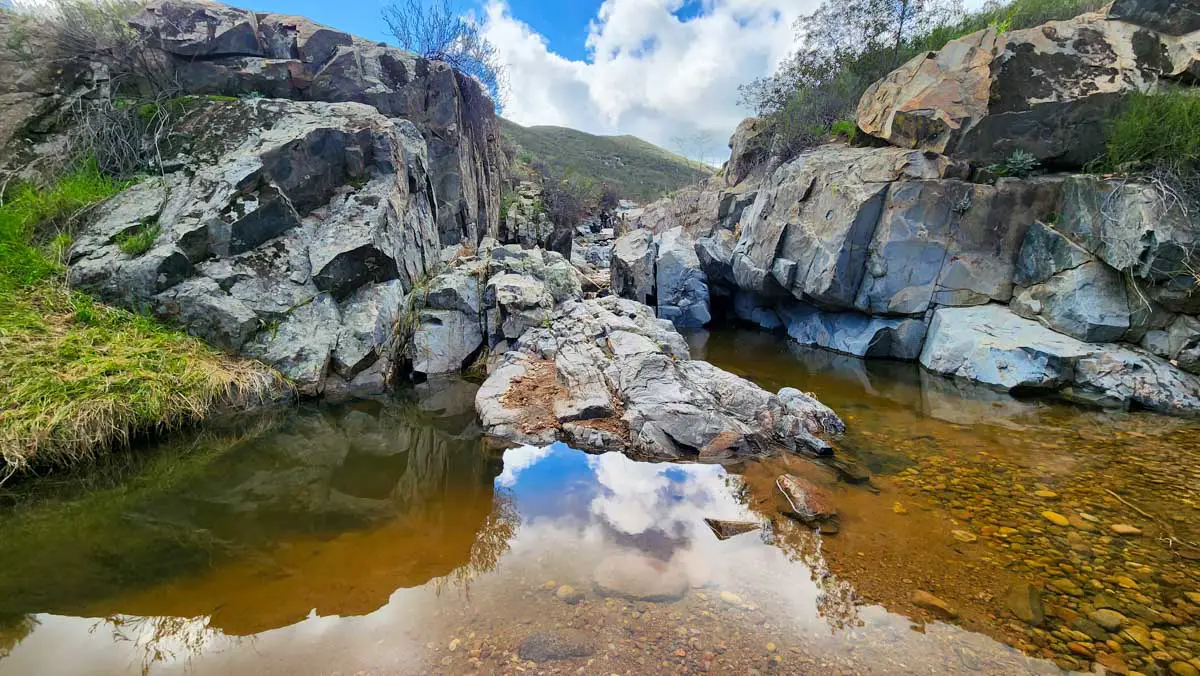
It’s about a tenth of a mile from the big tree to a sharp westward bend in the trail and the first of two small gorges. After a rain, the top of the gorge forms a waterfall. Watch your footing and any small children in this area, as the side of the trailside drops off into the gorges rock walls in places.
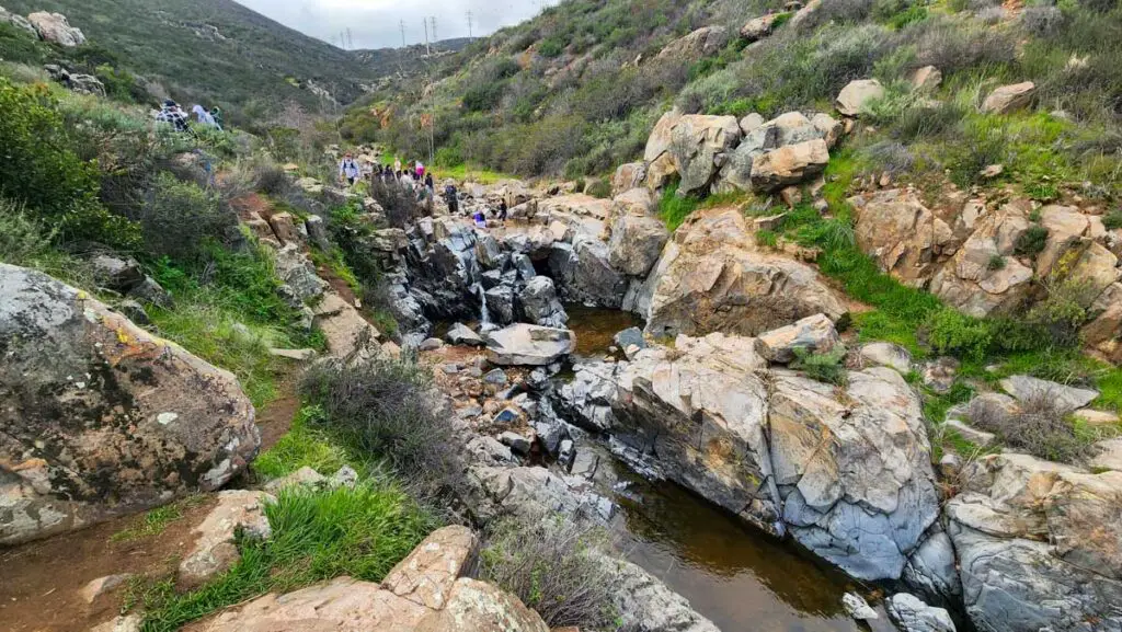
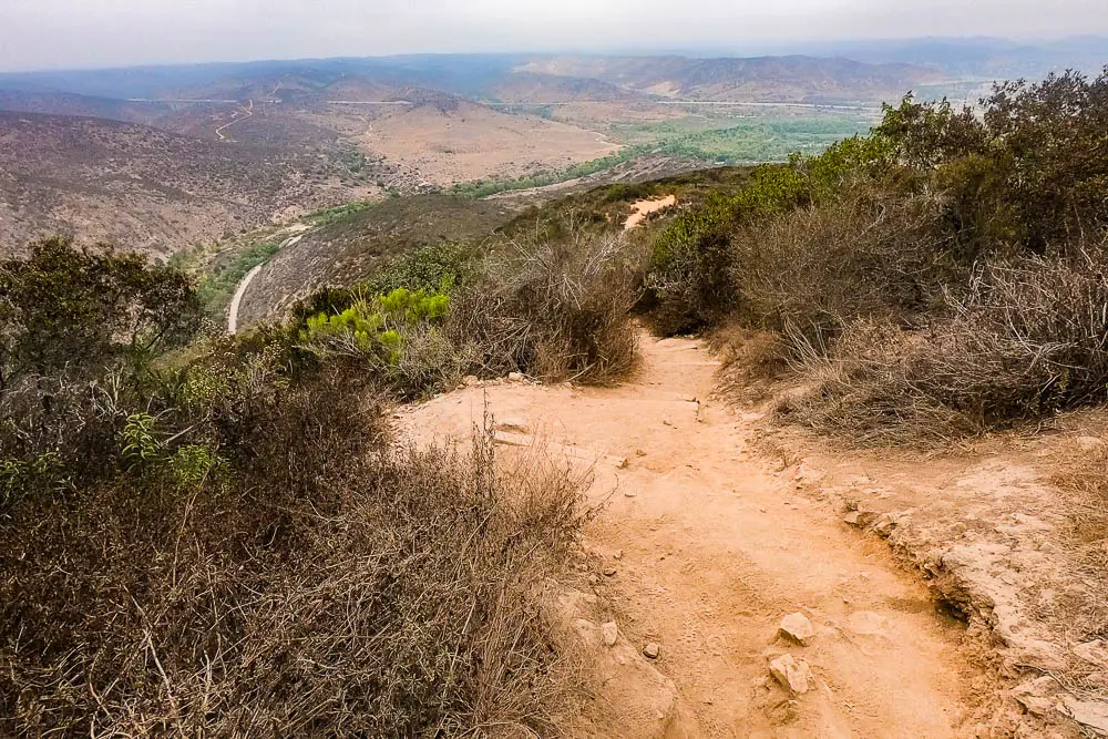
From here the trail becomes more rugged, as it follows the bedrock of the creek and begins to climb a bit more steeply up the canyon. Two-tenths of a mile from the first waterfall, you’ll come to a second, larger waterfall that spills into another small gorge.
This is a nice spot to stop for a break along the edge of the gorge next to the falls. As this is the highlight when it comes to points of interest along the trail, some hikers will head back once they’ve spent some time at the waterfall.
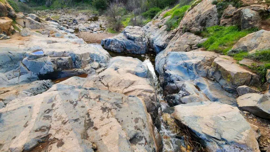
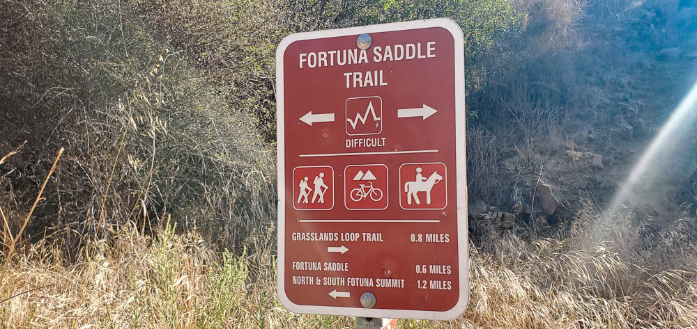
The waterfalls are really the highlight in terms of points of interest on the trail. But if you’re looking to hike a bit further, the trail crossed over the creek just about the falls and continues to follow the creekbed up the canyon for about 500 feet before connecting with Fortuna Saddle Trail.
The fork to the right heads south and can be used to connect to the Grasslands Trail Loop. The fork to the left heads west and will eventually bring you to the saddle of Fortuna Mountain, with trails heading to the north and south peaks of the mountain.
There is also another section of Oak Creek Canyon Trail that can be explored by heading left at the fork. In about 450 feet, take the left fork in the trail which follows the creek north through the canyon.
After a little under half a mile, the trail connects with a dirt service road near Highway 52. From here you can head left to a tangle of service roads that connects to a lower section of North Fortuna Summit Trail or head back on Oak Creek Canyon Trail (our recommendation).
Other Mission Trails Hikes
Kwaay Paay Peak Trail
This steep 2.5-mile out-and-back route climbs 885 feet from Mission Gorge to the 1,194-foot summit of Kwaay Paay Peak.
Cowles Mountain Trail
The summit of Cowles Mountain, the highest point in the City of San Diego at 1,591, offers terrific 360-degree views of San Diego.
Climbers Loop Trail
This short but steep loop climbs 400 feet to a popular rock climbing crag in Mission Gorge
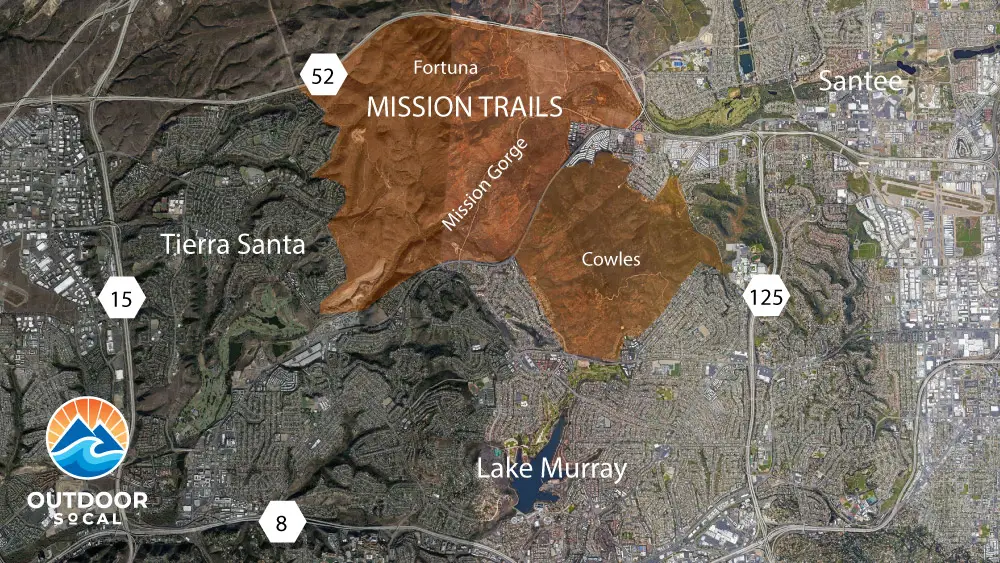
About Mission Trails Regional Park
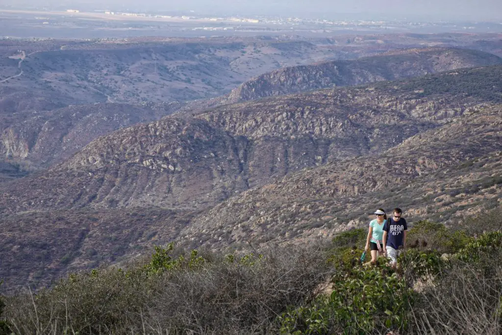
Located about 8-miles northeast of downtown San Diego, Mission Trails Regional Park encompasses more than 8,000 acres of mountainous open space that is popular among hikers, mountain bikers, and rock climbers.
The San Diego River flows through Mission Gorge, offering a rare year-round source of flowing water in this arid landscape. Despite being surrounded by suburban neighborhoods, the park’s coastal sage, chaparral, and riparian ecosystems are home to numerous animals, including bobcats, coyotes, deer, and many native lizard and bird species.
The visitor’s center, located at the western end of the gorge, offers great information on the park’s human and natural history.