Telescope Peak Trail – Death Valley

Telescope Peak is a 14-mile out-and-back trek in Death Valley National Park, California, known for its challenging ascent and panoramic views. With a difficult rating and about 3,000 feet of elevation gain, this route appeals to experienced hikers seeking a high-elevation adventure in one of the most rugged corners of the park.
Located near the end of Upper Wildrose/Emigrant Canyon Road, the trail takes you through desert woodland, across dramatic ridges, and eventually to the summit overlooking both the lowest point in North America and, on clear days, the towering Sierra Nevada mountains in the distance.
Those who make the effort will be rewarded with sweeping vistas into Death Valley and Panamint Valley. The trek is best for prepared hikers comfortable with steep switchbacks and high-altitude conditions. The final stretch is narrow and may test your tolerance for exposure, but the summit panorama is unforgettable. Bring plenty of water and always carry proper navigation tools.
Trail Details
| Trail Type | Out-and-back |
| Difficulty | Difficult |
| Length | 14 miles (22.5 km) |
| Time | 7 hours (round trip) |
| Elevation Gain and Loss | +3,000 ft / -3,000 ft |
| Trailhead Coordinates | 36.2294488, -117.068458 |
| Location | Death Valley National Park, CA |
| Season | Year-round (best in cooler months) |
| Information Number | 760-786-3200 |
Getting to the Telescope Peak trailhead

The trail to Telescope Peak begins from Mahogany Flat Campground at the end of Upper Wildrose/ Emigrant Canyon Road. High clearance and 4×4 are recommended for the final 1.5 miles to the campground. The road is steep, rough, and narrow. Hikers with low-clearance vehicles should consider parking at the Charcoal Kilns and walking the road to the trailhead.
The Trail

Starting at Mahogany Flat Campground (approximately 8,200 feet in elevation), the Telescope Peak Trail begins with a steady climb along the eastern slope of the Panamint Mountains. Early on, you’ll pass through a mixed forest of pinyon pine and mountain mahogany, which can partially block views into the valley below. After about a mile, the foliage thins out, offering the first sweeping glimpses into Death Valley’s dramatic landscape.

The trail maintains a moderate but unrelenting incline as it skirts below Rogers Peak. Around 2.4 miles in, you reach Arcane Meadows—a relatively flat saddle offering panoramic views into both Death Valley and Panamint Valley. Many backpackers choose this as a campsite, but day hikers will likely continue straight through.

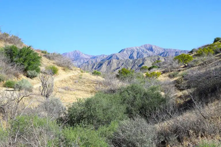
Beyond Arcane Meadows, the path follows a narrow ridgeline for roughly 1.5 miles, offering some of the most striking vistas in the park. Here, you might spot the occasional limber pine and, higher up, the ancient bristlecone pines—some of the oldest living organisms on Earth.
The trail then begins a steeper set of switchbacks, gaining over 1,000 feet in about three miles. Watch your footing and pace yourself, as the elevation can be taxing.

The final 0.2-mile approach to the summit is a narrow ridge that can be nerve-racking for those with vertigo. Once on top at 11,049 feet, you’ll stand above Badwater Basin, the lowest point in North America at -282 feet below sea level. On a clear day, look west toward the Sierra Nevada range, where Mount Whitney towers at 14,505 feet. After soaking in the views, retrace your steps back to the trailhead.
Camping
Mahogany Flat Campground is situated right at the trailhead, offering ten sites that fill quickly on holiday weekends. This basic campground has no water, so bring your own supply.
Slightly lower in elevation, Wildrose Campground is another option if Mahogany Flat is full or if you prefer a less rugged drive. Both campgrounds operate on a first-come, first-served basis and have vault toilets but no potable water. For more camping options, check out our Death Valley Camping Guide.