Ocotillo Wells State Vehicular Recreation Area – Desert Off-Roading Guide
Ocotillo Wells State Vehicular Recreation Area (SVRA) spans roughly 85,000 acres of open desert terrain in Southern California’s Colorado Desert region, adjacent to Anza-Borrego Desert State Park. Popular among off-highway vehicle (OHV) enthusiasts, the park features wind-sculpted sand dunes, rugged badlands, and unique geologic formations like the “Pumpkin Patch.”
Destination Details
| Season | October through April (cooler months recommended) |
| Location | Anza-Borrego Desert, Southern California |
| GPS Coordinates | Approx. 33.1645, -116.1035 |
| Management | California State Parks, OHMVR Division |
| Size | ~85,000 acres of open desert |
| Nearest Major City | San Diego (approx. 90 miles to the east) |
| Fees | None for day use or camping |
| Facilities | Vault toilets, shade ramadas, picnic tables, fire rings |
| Water Availability | No on-site water; bring your own supply |
| Nearby Services | Fuel, repairs, groceries, and lodging in Borrego Springs, Ocotillo Wells, and Salton City |
How to Get to the Destination

From San Diego, head east on Interstate 8 and take County Highway S2 north toward Ocotillo. Follow signs for Ocotillo Wells SVRA and continue to the park entrances located along Highway 78.
Coming from the north, travelers on Interstate 10 can exit onto Highway 86S or Highway 111 and make their way south to Highway 78, then head east to the park. Fuel, basic groceries, and some lodging options are available in nearby towns such as Borrego Springs and Salton City.
Destination Overview
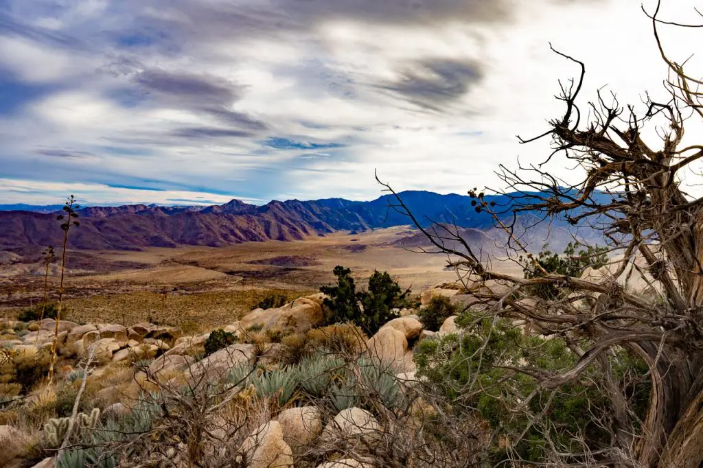
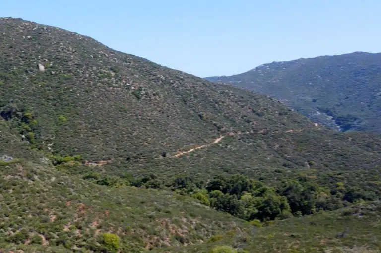
Ocotillo Wells SVRA is characterized by vast open desert landscapes, rolling sand hills, and intriguing geologic features formed over millions of years. Managed by California State Parks, the area invites visitors to explore an otherworldly environment where wind, water, and tectonic activity have shaped the terrain.

The area is quite large, and typically visitors will either focus on the northern portion near Truckhaven entrance, off the S22, or southern portion near Discovery Center entrance, off Route 78.
On the map above, you’ll see that the southwestern side of the OHV area is lighter colored, and the western and most northern portion are darker. The lighter portions are open riding (“dispersed riding”) while on areas indicated by the darker color you need to stay on dirt roads and established off-road trails.
Points of Interest
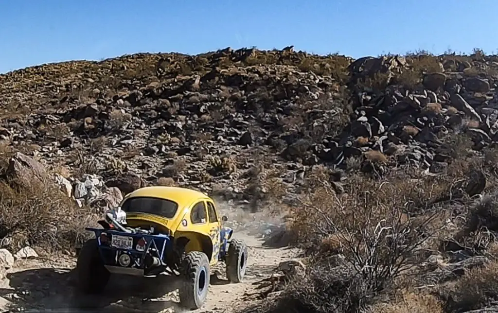
Ocotillo Well offers a plethora of trails and landscape features to explore, and you don’t really need a specific destination to have a terrific adventure. That said, below are a few well known points of interested withing the OHV.
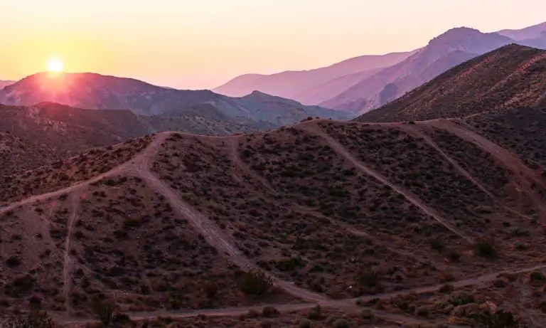
Blowsand Hill
Blowsand Hill is a towering dune formed by wind-blown sand and is one of the most popular sites in Ocotillo Wells. On many weekends, the dune glows under a circle of headlights as off-road vehicles tackle its shifting slopes. The location affords sweeping views of the surrounding desert, making it a favorite for sunset watchers. GPS: 33.1615524, -116.156215
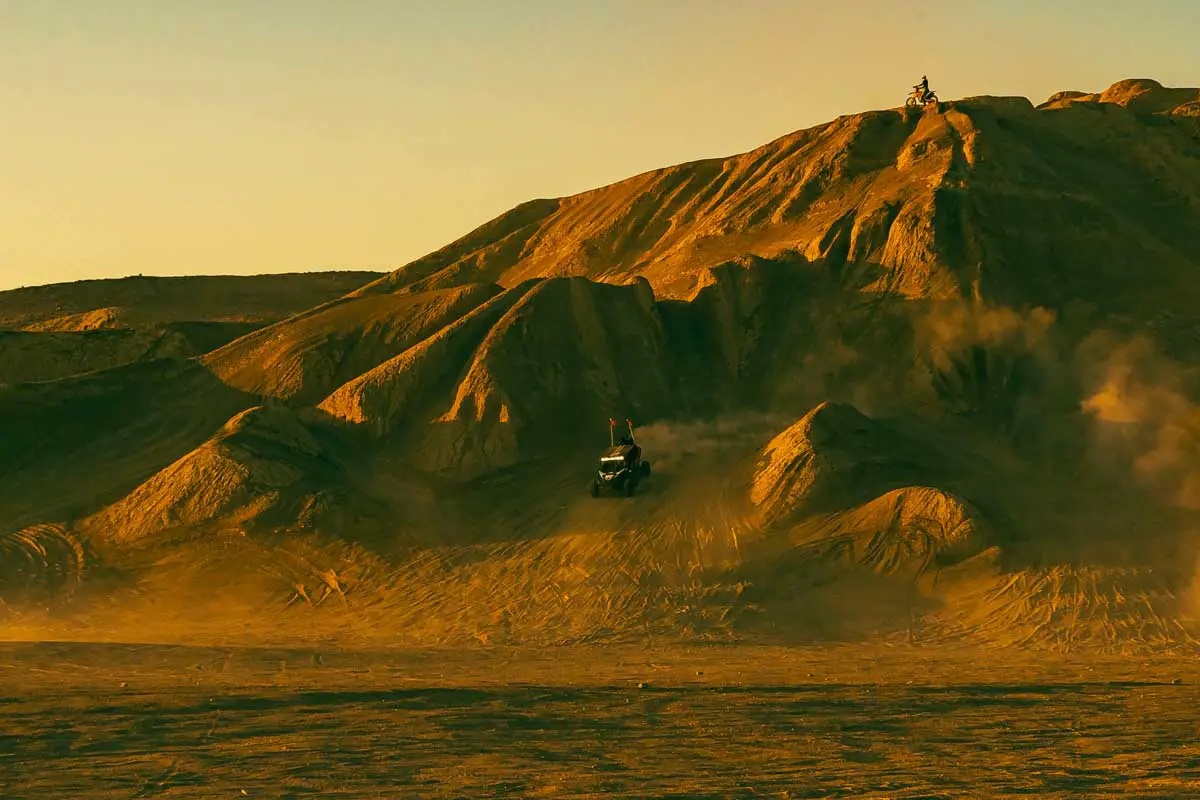
Devil’s Slide
Devil’s Slide is a 200-foot slope of decomposing granite that poses a thrill for off-roaders seeking a steep, sandy challenge. Its rugged terrain and dark desert varnish offer a dramatic contrast against the pale desert floor. Hidden mine shafts near the mountain add an air of mystery, with local legends claiming they are haunted. GPS: 33.179158, -116.110045
Shell Reef

Shell Reef showcases the region’s ancient marine past, where fossilized oyster shells dating back roughly four million years are scattered across the desert floor. These delicate remnants are revealed by ongoing wind and water erosion, offering a fascinating window into prehistoric life. GPS: 33.188438, -116.074605
Barrel Springs
Barrel Springs is an oasis-like area where water seeps to the surface, particularly after significant rainfall. Surrounded by mesquite-covered sand dunes, it draws desert wildlife seeking shade and hydration. Archaeological evidence suggests that Native Americans once gathered here for rest and trade, highlighting its cultural importance. Fenced sections help protect the fragile environment, and visitors are encouraged to tread lightly to preserve the site. GPS: 33.1772659, -116.103175
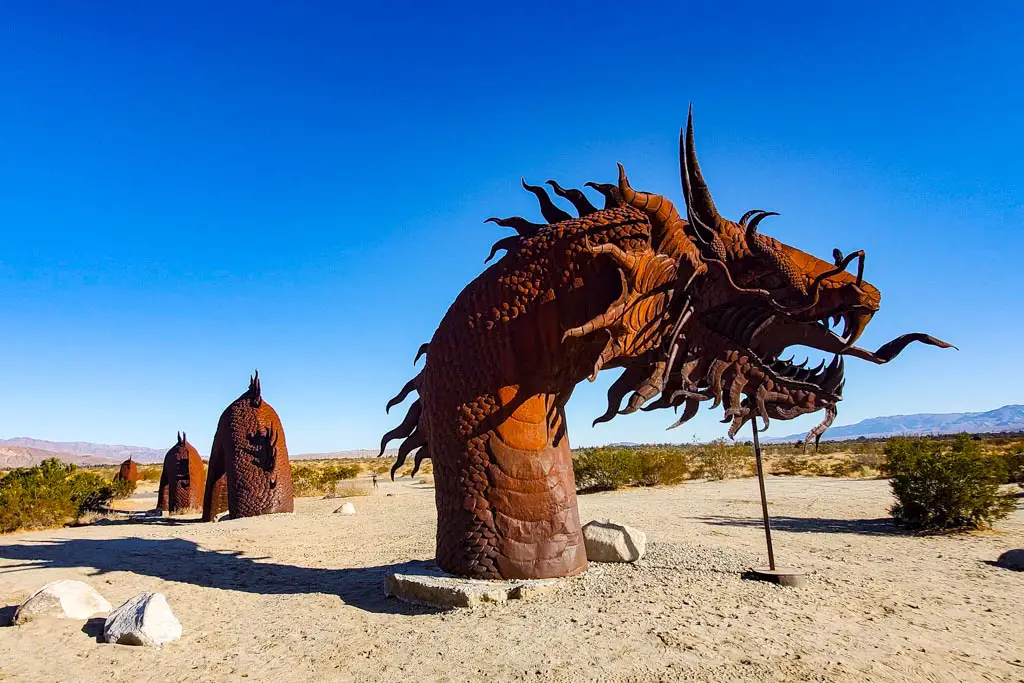
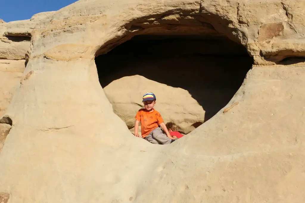
Pumpkin Patch

Pumpkin Patch is a quirky geological site where spherical sandstone concretions have been revealed by centuries of wind and water erosion. These “pumpkins” form when sand particles naturally cement around a small object, such as a shell or pebble. The result is a field of rounded, otherworldly shapes scattered across the desert floor. More Info
Gas Domes
as Domes are natural mud pots where gas bubbles rise through mineral-rich, muddy water, creating a mesmerizing display on the desert floor. This phenomenon occurs when underground gases find a pathway to the surface, forming constant ripples and soft pops as they escape. The area’s geothermal activity and unique soil composition contribute to its unusual appearance. GPS: 33.166600, -115.944160
Artesian Well
Near the Gas Domes, Artesian Well in Ocotillo Wells is an abandoned 1919 drilling platform, a vestige of early oil exploration. Instead of black gold, prospectors tapped into scalding hot geothermal water, creating a rare artesian well in the desert. Water still flows from a pipe that the oil speculators drove deep into the ground. GPS: 33.166589, -115.944148
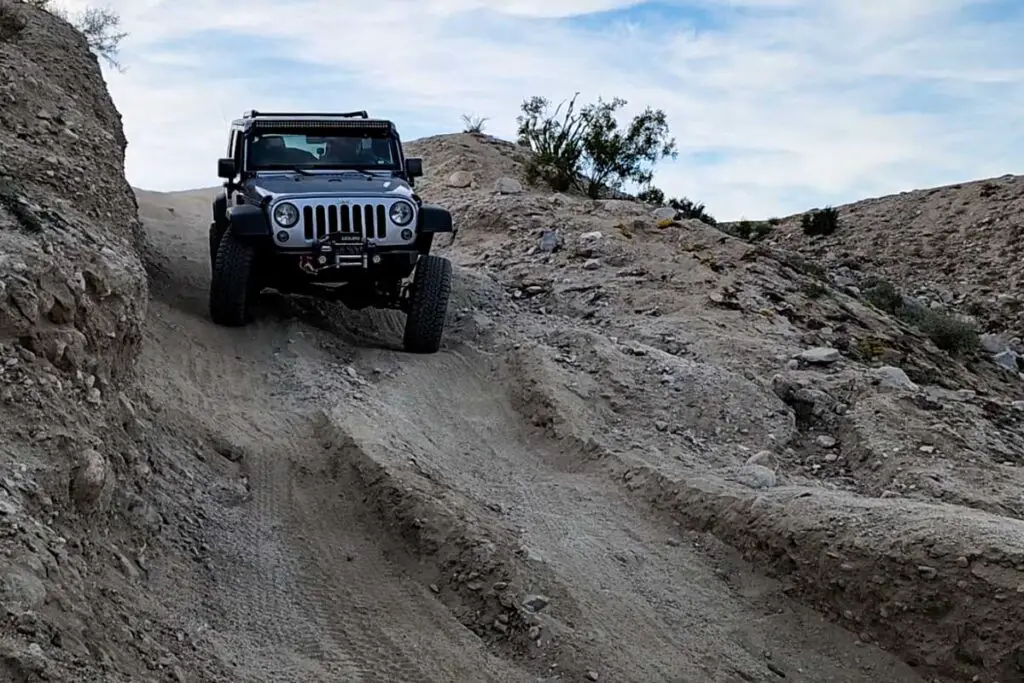
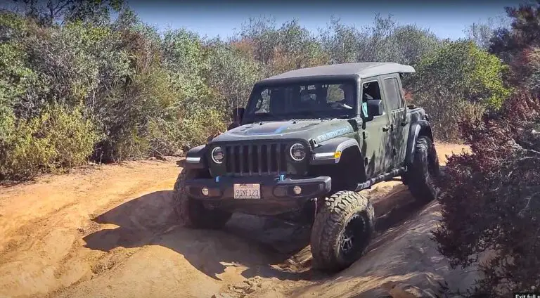
Truckhaven 4×4 Training Area
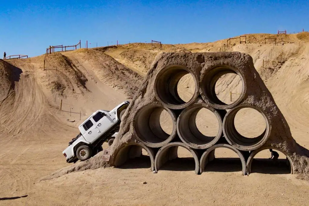
In addition to the open space for off-road exploration, within Ocotillo Wells is Truckhaven 4×4 Training Area, a fenced section of desert that offers manmade off-road obstacles of a range of difficulty. Here’s a video guide to Truckhaven that I put together:
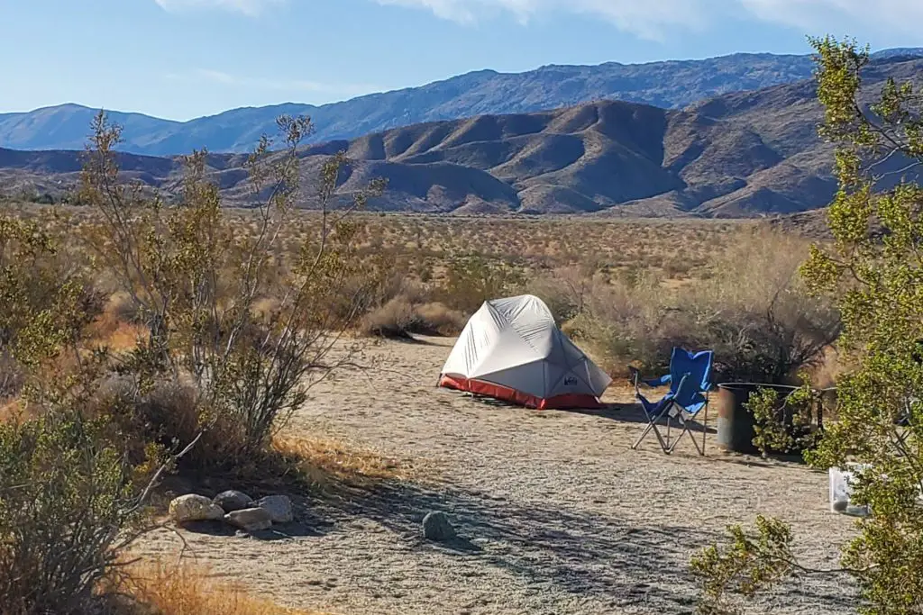
Camping
Open camping is permitted throughout much of the SVRA for up to 30 days per calendar year. There are no fees for camping, and sites are generally first-come, first-served. Vault toilets, shade ramadas, picnic tables, and fire rings can be found in designated areas such as Quarry, Main Street, and Holmes Camp.
- No Water On-Site: Bring ample water for drinking, cooking, and cleaning.
- Restrictions: Camping is not allowed at Shell Reef, Devil’s Slide, Blowsand Hill, The Notches, or 4×4 training areas.
- Showers: Pay showers are available at certain locations (Main Street, Holmes Camp). Bring quarters if you plan to use them.
For other options, check out our comprehensive guide to camping in Anza-Borrego.
Safety and Tips
- Navigation: Whether riding or hiking, carry detailed maps or GPS.
- Heat Precautions: Desert temperatures can soar; pack extra water and limit strenuous activity during peak heat.
- Lost or Injured: Contact a park ranger immediately if someone in your group is missing or injured.
- Respect the Environment: Help preserve fragile areas, especially near oases like Barrel Springs and around geological features like the Pumpkin Patch.
Safe and Responsible OHV Operation
Safe and responsible OHV operation starts with proper training. The OHMVR Division has partnered with the Specialty Vehicle Institute of America, Recreational Off-Highway Vehicle Association and the Motorcycle Safety Foundation to provide FREE ATV, ROV and dirt bike training. For the list of classes and other information about OHV safety training, please reference the webpages below.
ROV Safety Training
Training Schedule (List of Classes for all OHVs)
ATV Safety Training
Dirt Bike Training
Other Trails
For other off-road trails, check out our guide to Anza-Borrego off-roading.